

Signal du Lamet
Description
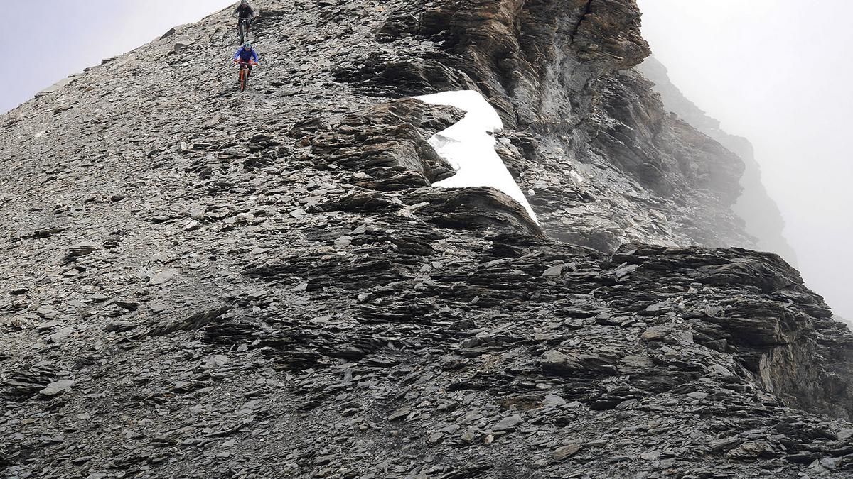
From Susa, the ascent to Lac du Mont Cénis is ideally done by shuttle. The ascent to the Signal du Lamet begins above the dam wall, where the road reaches its highest point. A gravel road branches off here, which you follow for a short distance. On the right, the route turns into a singletrail that rides to the next gravel road. Follow this uphill until the trail to Signal du Lamet begins on the left. This can be ridden up to the ruins of a military installation for strong mountain bikers, otherwise you have to push your bike. After the ruins, the path is steeper and the bike has to be carried. The route rides in this way with wonderful views of the Lac du Mont Cénis up to the summit of the Signal du Lamet (3480 meters above sea level). The tour descends along the same route, which is challenging up to the ruins, but is extremely flowy to ride afterwards. Instead of returning to the starting point, however, you then follow the gravel road downhill, then a stretch on the pass road until the bumpy path to Moncenisio branches off to the left. At the small village, turn right onto the access road until a trail branches off to the left again. This is nice to ride and has some more technically challenging sections in the lowest section. Finally, you reach the village of Novalesa, from where you roll down the road to the bridge over the Cenischia stream. From here, you roll left along the river to the center of Susa.
Map & GPX-Track
The map is only available to Ride subscribers.
The Ride-Subscription is available at ride-mtb.com/abo
.
Details of the tour
38 km
1470 m
3015 m
494 above sea level
3455 above sea level
1 day
Susa
Susa
1721
not suitable
More information
More tours nearby





User comments (2)

About the author: Thomas Giger
Note: This content has been automatically translated from German. Please report any incorrect translations.
Have also deposited the bikes under the summit, agree with the previous report.
The last trail after Lago Foppa is unkempt, the last storms have taken their toll on it and it is also overgrown. We recommend taking the Stada Reale trail from Lago Grande to Novalesa.
Top tour. We had to deposit the bike 300m below the summit, as most of the trail then becomes very bad, exposed and difficult. So several S4 to S5 sections and G3 to G4 in our opinion