

Mont Cenis – Fort Malamot

Description
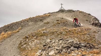
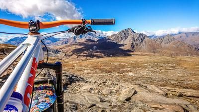
The route starts at the beautiful and somewhat bizarre Lac du Mont Cenis. Many buildings from the past characterize the shores of the lake. The settlement area was repeatedly intersected with defensive lines, resulting in a breathtaking network of paths, which in this case also ride up to the summit to Fort de Malamot on the summit of Pointe Droset. However, it is not made too easy, as the ascent rides uphill on an unpaved old military road. The reward is a breathtaking mountain panorama and lost places.
The descent then heads west along the ridge on difficulty levels S1 to S2 to a huge bunker complex, the Fort de Pattacreuse. From here, you briefly rejoin a feeder road from that time before taking the trail cut-offs to above the reservoir. You then cross this road below the gigantic Fort de Variselle fortress before arriving back at the starting point at the Lac du Mont-Cenis reservoir. This is a breathtaking tour, especially in autumn when the air humidity is low and visibility is good, and the magnificent ascent and scenic highlights alone are impressive.
Map & GPX-Track
The map is only available to Ride subscribers.
The Ride-Subscription is available at ride-mtb.com/abo
.
Details of the tour
22 km
990 m
990 m
1953 above sea level
2890 above sea level
1 day
Lac de Mont Cenis
Lac de Mont Cenis
2232
well suited
More information
More tours nearby





User comments (1)

About the author: Martin Depauli
Note: This content has been automatically translated from German. Please report any incorrect translations.
Beautiful tour, but the first 150m of the descent are not rideable due to a lack of trail. Here the track leads down the high mountain slope to the small lake. Then follow the road and the cut-offs are great, although there are certainly some S3 sections too