

Monte Denervo

Description
La Dolce Vita: Lake Garda has been attracting countless climbers, surfers, sailors - and of course bikers - for almost thirty years. No wonder, given the mix of beach life and Mediterranean flair. Lago di Garda, also known as "Bénaco", is the largest lake in Italy. It measures 52 kilometers from Riva at the northern end to Sirmione in the south and 17 kilometers at its widest point. It is up to 346 meters deep. Thanks to its strong winds, it is considered one of the best sailing and surfing areas in the Alps. And one of the best biking areas. Three decades after its discovery as a biking spot, there is no corner of the lake that has not been tested for its suitability for biking. No other destination on the planet has had more tours published, whether in book form or online. There are a dozen different ways to conquer the famous Tremalzo trail, making it all the more surprising that there are still real insider tips within sight of the hotspots - especially in the south-west of the lake - where you can still experience the old Garda spirit completely undisturbed by hundreds of people. Like in Pieve, for example: if you like dizzying vacations, check into the Hotel Paradiso 350 meters above the lake. However, you shouldn't be afraid of heights ...
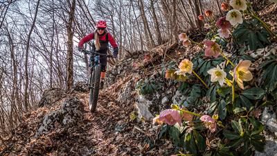
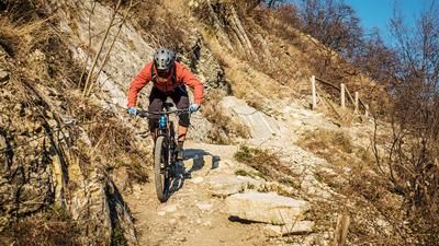
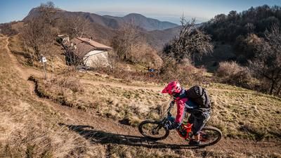
Nearby, the small super tour to Monte Denervo beckons: from the idyllic fishing village of Gargnano (100 m), you ride up to Piovere on the old panoramic road. Over half a dozen hairpin bends on a virtually car-free asphalt road, you reach the plateau of Malga Premaùr. Up to the saddle between Monte Denervo (1373 m) and Cima Comer (1279 m) you have to push from time to time, but the reward is a 900-metre descent of the very finest. After refreshments at the Rifugio Gargnano (985 m; only open on Sundays; tel. 00 39/03 65/79 00 15), you can follow a narrow trail - sometimes dangerously close to the edge of the slope - down to Gargnano. The most beautiful part: Only the peonies are watching! But watch out: acute danger of falling!
Map & GPX-Track
The map is only available to Ride subscribers.
The Ride-Subscription is available at ride-mtb.com/abo
.
Details of the tour
23 km
1165 m
1165 m
66 above sea level
1222 above sea level
1 day
Gargnano
Gargnano
1920
well suited
More tours nearby




User comments (0)
Note: This content has been automatically translated from German. Please report any incorrect translations.