

Croce Faure – Punta Guardiol

Description
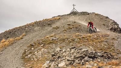
The route starts on the Strada Statale 24 del Monginevro, between Oulx and Cesana Torinese. From here, the route initially winds along asphalt and gravel, later on the old military road via Pra Claud towards Monte Chaberton. At an altitude of around 1900 meters above sea level, you then leave this feeder road and wind your way steadily uphill on another old military road to the summit at 2340 meters above sea level, Punta Guardiol. The gentle ascent makes the summit relatively easy to reach and still offers a fantastic 360-degree panorama.
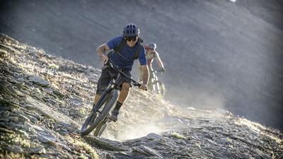
The descent contributes to making the tour a highlight in this area. Initially at a difficulty of S1, later up to S2, it feels like half an eternity meandering towards Millaures. The crossing through the valley in particular is a real dream for anyone who loves surfing trails. At Millaures, the route then leads to Autagnas and from here on difficulty S1 to Desertes. Now the trail becomes a little more difficult with up to S3 in places. This is the way back to the starting point. All in all, another tour highlight in the Susa Valley, which impresses with its solitude and extraordinary views. However, it should be noted that the sandy ground can cause the trail to wash out during heavy rain and thunderstorms. A clear assessment of the level of difficulty cannot therefore be defined 100 percent, or can change constantly as a result.
Map & GPX-Track
The map is only available to Ride subscribers.
The Ride-Subscription is available at ride-mtb.com/abo
.
Details of the tour
21 km
1190 m
1190 m
1231 above sea level
2304 above sea level
1 day
Fénis
Fénis
2228
limited
More information
More tours nearby





User comments (0)

About the author: Martin Depauli
Note: This content has been automatically translated from German. Please report any incorrect translations.