

Monte Appenna

Description
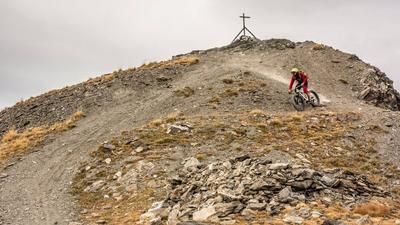
The starting point is near the well-known winter sports resort of Sestriere. A little further down, in Sauze di Cesana, the trail leads southward on gravel along the Torrente Ripa to the Rifugio Alpe Plane. The ascent is varied, with moderate to steep gradients, while the landscape provides an impressive backdrop. From the hut, it’s time to push or carry your mountain bike. This way, you’ll tackle nearly 900 meters of elevation gain. Upon reaching Monte Appenna, a simple sign marks the highest point of the tour, which rewards you with a fantastic panoramic view and the typical Western Alps atmosphere. Far from heavily trafficked trails, you can enjoy the solitude here in the heart of the Western Alps, surrounded by countless three-thousand-meter peaks.
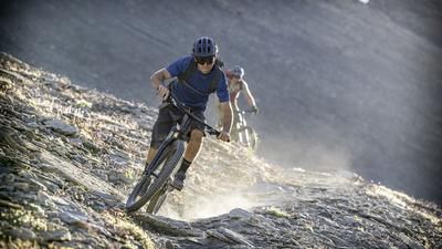
The descent is extremely varied. Technically, it mostly ranges between S1 and S2, which isn’t extremely demanding in terms of riding technique, but the section above the tree line is in a class of its own. At an altitude of around 2,200 meters above sea level, a traverse begins that is easy to manage in sections and ultimately leads to the Bivacco Ugo Ratazzo. Afterward, you continue rolling northward along the access road. From the small hamlet of Bessén Haut, you can take advantage of smooth trail shortcuts that lead directly back to the starting point. Overall, this is a very impressive, albeit long and demanding, adventure that captivates above all with its magnificent scenery.
Map & GPX-Track
The map is only available to Ride subscribers.
The Ride-Subscription is available at ride-mtb.com/abo
.
Details of the tour
19 km
1480 m
1480 m
1537 above sea level
2922 above sea level
1 day
Sauze di Cesana
Sauze di Cesana
3663
not suitable
More information
More tours nearby





User comments (1)

About the author: Martin Depauli
Note: This content has been automatically translated from German. Please report any incorrect translations.
I rode—or rather, pushed—the route without reaching the summit. Also, Monte Appenna is quite a distance from the Italian-French border, not as shown in the picture. Additionally: The picture doesn’t match the mountain at all! The Valle Argentera is a scenic dream—outside of vacation seasons and weekends—since it’s heavily frequented by countless campers, enduro riders, ATV riders, and off-roaders. The last few meters to Alpe Plane are a ramp in rather poor condition; I rode the switchbacks via Pian della Milizia, which are no less steep but more rideable. From Alpe Plane onward, trust the GPS data until the trail becomes clearly visible. I rode to the trail fork at approximately 2,500 meters above sea level; I skipped the summit due to the lack of a discernible trail and instead took the Sentiere Balcone high-altitude trail directly. If you enjoy pushing your bike through mostly trail-less terrain—this is the place for you. There are plenty of well-trodden paths, all neatly laid out by the cows, and even where there is a trail, it’s hardly rideable—it’s simply been trampled to pieces. By the way: Be sure to follow the GPS track! From the Bivacco, take the forest road, and the trail starting at Bessen Haut at least makes up for it a bit. Bottom line: It’s doable—the Valle Argentera is definitely beautiful—but if you’re looking for good trails, this isn’t the place for you.