

Cima di Vallonetto / Pointe Sommeiller

Description
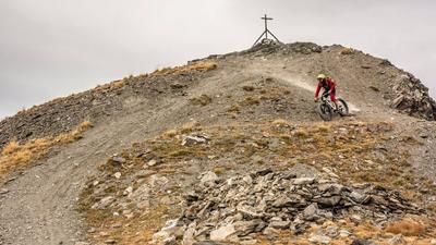
The tour starts in the small village of Oulx in the Susa Valley. From here, the route follows the stream to Bardonecchia and continues up the road towards the Sommeiller Pass. Originally, a summer ski area was built in this side valley at over 3000 meters above sea level. All that remains today is the mountain road, a perfect access point for mountain bikers with a few excellent routes. Everything up to Pian dei Frati can be ridden at an altitude of 2800 meters above sea level. Now it's time to push and carry the bike towards Pointe Sommeiller / Punta Sommeiller at 3333 meters above sea level. Once here, you have a magnificent panoramic view as far as Lake Sommeiller, the former ski resort and the Italian/French border ridge. From the summit, the route descends southwards for a few meters at a difficulty of S2 to S3 and then pushes or carries you back up to the Cima del Vallonetto at 3217 metres above sea level. It should be noted that the last few meters to the summit should be pushed on the ascent and also on the descent. On the Cima del Vallonetto, you can see as far as Turin in good weather and the Maritime Alps to the south. The French ice giants can also be seen to the north and west.
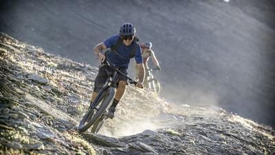
The first 50 vertical meters of the descent are covered by pushing, after which a trail with a difficulty of S1 to S2 begins all the way back to Oulx. Along the southern ridge, you ride past old positions of the Vallo Alpino or from Napoleonic times and take curve after straight, flow sections on technical passages, as well as berms and jumps. A never-ending trail that dives into the forest at some point and accompanies us back to Oulx through larch and Swiss stone pine forests. With a total of 2300 Elevation loss, this is a full trail that is sure to break a few personal biking records.
Tip: The long ascent can be shortened considerably with the bike shuttle in Oulx. An asphalt road rides up to the village of Rochemolles, followed by a gravel road. It is possible to shuttle to the Rifugio Scarfiotti without any problems.
Map & GPX-Track
The map is only available to Ride subscribers.
The Ride-Subscription is available at ride-mtb.com/abo
.
Details of the tour
51 km
2400 m
2400 m
1070 above sea level
3260 above sea level
1 day
Oulx
Oulx
2029
limited
More information
More tours nearby






User comments (3)

About the author: Martin Depauli
Note: This content has been automatically translated from German. Please report any incorrect translations.
Great tour - the last part of the descent from around 2000 ünN has severe erosion damage in places. Most of it is still rideable, but certainly no longer the described s1/2 flow wonder that it perhaps once was.
Alternatively, a trail can be found at 2050 to the west, which would be described in Trailforks. However, we followed the ride route.
I did the tour yesterday - wow, that's great cinema! But not to be underestimated either. After leaving the mountain road at 2650 m, the bike has to be pushed another 700 m and mostly carried. The transition at Cima Vallonetto also requires alpine experience with the bike on your back - partly exposed and especially from the Bivacco, a very steep descent over 100 m in the scree field has to be mastered. A carrying system for the bike is clearly an advantage to have your hands free for holding and supporting.
As a reward, however, the fantastic, epic trail follows. Initially still S1-S2, then increasingly difficult in the forest and pretty tough at the bottom with some S3 sections. You shouldn't be out of breath in terms of fitness...
Incidentally, you can save almost 200 m on the ascent if you take the train from Oulx to Bardonecchia.
Great tour! @Cima del Vallonetto. It should be noted that the last few meters to the summit should be pushed on the ascent and also on the descent:
Ascent not rideable, the last 100m the bike has to be pushed/carried, as it crosses a steep gravel field and is secured by ropes over rocks to the summit
Descent: Steep, wide gravel cirque. We had to push our bikes 200m down to the shoulder.
There were certainly some S3 sections, but the rest was very epic!