

Col du Vallon

Description
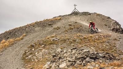
The tour begins in Valle Stretta at the Pian del Colle parking lot. Just above the campground, you first follow a paved road; later, the surface changes to gravel and leads directly into Valle Stretta toward the Rifugio I Re Magi mountain hut. From the Rifugio, the trail becomes increasingly rough and the uphill climb significantly more challenging, until you eventually have to push your bike all the way to the Maison de Chamois. From there, the route continues on a singletrack that is rideable in places but mostly requires pushing. At the junction toward Mont Thabor, keep left and you’ll eventually reach the highest point of the tour at Col du Vallon.In terms of scenery, the area is more reminiscent of the Dolomites than the Western Alps. The transition and the descent toward the south are particularly impressive. The downhill ranges from difficulty S2 to S3 in the key sections and offers very smooth stretches in between. In what feels like an endless descent, the route passes the Saint Michel chapel and heads down to Névache. From there, follow the paved road through the villages and begin the return climb over the Col de l’Echelle. This uphill section is relatively short and pleasant to ride. At the pass, you’ll pass several Vallo Alpino facilities and, at the first hairpin turn, take the technically somewhat challenging trail back to the starting point.Note: If you still have energy to spare, you can extend the tour by about 800 meters of elevation gain and include Mont Thabor. With a lightweight electric mountain bike, the entire loop is quite manageable, as the sections requiring pushing remain manageable.
Map & GPX-Track
The map is only available to Ride subscribers.
The Ride-Subscription is available at ride-mtb.com/abo
.
Details of the tour
30 km
1350 m
1350 m
1458 above sea level
2612 above sea level
1 day
Pian del Colle
Pian del Colle
3623
limited
More information
More tours nearby



User comments (1)

About the author: Martin Depauli
Note: This content has been automatically translated from German. Please report any incorrect translations.
I rode the route on September 16. The scenery is very, very beautiful! The trail is seemingly endless and just as described. As for the climb: after the turnoff (toward Mont Thabor), the route to l’Echelle is a mix of pushing and riding—especially the final stretch to the pass, which is a steep section where you have to carry your bike. But the view from the top is a real WOW!