

Dent de Rez

Description
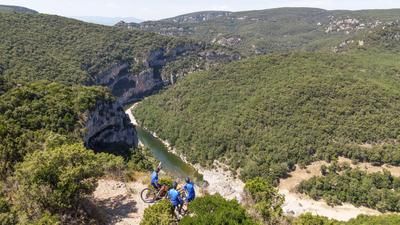
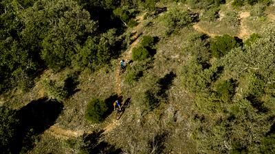
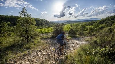
The tour over the Dent de Rez starts in Vallon-Pont-d'Arc in a north-easterly direction, into the Vallée de l'Ibie. After a few kilometers, the warm-up on the country road is over and the route rides into a singletrail along the Ruisseau de Baravon. The majority of the trail is easy to ride, but there are the odd stream crossing or unrideable section, which is why the tour is recommended in dry conditions. At the next opportunity, you change to the forest road on which the main ascent to Dent de Rez begins. After the Col de Baravan, the route leads into a singletrail with a short pushing section, after which you reach the open, where the trail ascent can be ridden again. The ascent is no walk in the park, but already offers views over the countryside. A little later, you reach the viewpoint of the Dent de Rez, where the view stretches for hundreds of kilometers. On a clear day, you can even see Mont Ventoux. The first section of the descent begins immediately after the viewpoint. After a few minutes, it's time to pedal again, past the Refuge Col d'Eyrole until the route rides back onto the singletrail. This is a mix of flow, challenging sections and short counter-climbs until you reach the main road to Vallon-Pont-d'Arc. After crossing the road, you reach the next descent via country lanes. This first leads broadly through a kind of forest tunnel and over a short but rideable singletrail ascent into the flowing, but also partly loose final descent.
- If you want to skip the first singletrail ascent through the wild Baravan valley, turn right onto the gravel road, the Chemin de Rez, 1 kilometer before the turn-off into the valley. After the Col de Baravan, this takes you back to the original route that leads to the Dent de Rez.
Map & GPX-Track
The map is only available to Ride subscribers.
The Ride-Subscription is available at ride-mtb.com/abo
.
Details of the tour
32 km
1240 m
1240 m
87 above sea level
708 above sea level
1 day
Vallon-Pont-d'Arc
Vallon-Pont-d'Arc
3028
well suited
More information
More tours nearby






User comments (3)

About the author: Balz Weber
Note: This content has been automatically translated from German. Please report any incorrect translations.
There are definitely much better variants in the area. The descents are all in the upper difficulty range with lots of loose gravel and only at the very end is the riding enjoyable. It takes a lot of suffering to enjoy this ride. And we completed this tour on e-bikes.
We did the tour today. The first and last trail sections were fun. In between, you ride 90% on loose gravel. Both uphill and downhill. When the trail gets narrower, the thorns and bushes scratch your arms and legs. As the tour advertises some of the best trails in the region, we will probably hire a kayak tomorrow.
Cool trails from Dent de Rez all the way back to Valon-Pont-D'Arc!