

Le Signal

Description
The Tour Le Signal is a bit of a carrot and stick. The carrot starts with the long ascent from Moutiers up to the summit. In one stretch, you climb 1550 meters in altitude. Although the gradient is pleasant, the mountain experience here has to be hard earned. The surface is asphalted up to 1700 meters above sea level. If you can and want to, you can shuttle up to here (there is a parking lot at the end of the road). The remaining 330 meters in altitude are ridden on a gravel road, which only gets a little rougher at the very end. But by then it is no longer steep. The gravel road rides up to the ridge, from where you should definitely make a detour to Le Signal. The panorama from this inconspicuous meadow summit is phenomenal and provides an excellent view of the many valleys in the Moutiers region with well-known towns such as Meribel and Courchevel. The glaciers of the Vanoise massif are also clearly visible in the background.
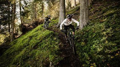
Now for the carrot! And so to the descent. This begins somewhat cautiously with a gravel road, but turns into a first trail at Lac de Bozon. This leads down to a larger meadow area, a few meters of rough gravel road are announced until an inconspicuous path branches off in a right-hand bend. This is the start of the bomb descent! The path rides smoothly through the steep terrain. Perfectly laid out and marked as a mountain bike trail. What more could you want? It feels like you flow endlessly through the terrain in this style, but at some point you are spit out onto a gravel road. However, this spook is short-lived, as you soon turn left onto the next trail section. Same quality level as before. How awesome is that? This is how you finally reach the village of Villargerel. This is followed by a mix of small roads and trails, just follow the MTB markings here. A traverse just above the valley floor finally leads down to Aigueblanche. Take the side road along the highway back to Moutiers. Conclusion: more of this stuff!Map & GPX-Track
The map is only available to Ride subscribers.
The Ride-Subscription is available at ride-mtb.com/abo
.
Details of the tour
38 km
1630 m
1630 m
465 above sea level
2035 above sea level
1 day
Moûtiers
Moûtiers
2588
well suited
More information
More tours nearby



User comments (1)

About the author: Thomas Giger
Note: This content has been automatically translated from German. Please report any incorrect translations.
I did this trail in early August as a stopover on my way to Briançon. It wasn’t a highlight, and maybe that’s exactly why it was so much fun. The climb isn’t particularly scenic, but it’s relaxed. There’s a drinking fountain along the way. The view at the top is nice, but it’s over quickly. The trail is long and fun, without being too challenging. It could use a bit of maintenance. But the tour has one major plus: it was absolutely deserted, and we had complete peace and quiet. So they do still exist—those quiet corners in the Alps.