

Monte Palon di Lius - Giro

Description
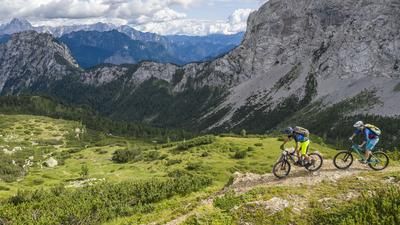
The tour begins in Val Aupa, below the small village of Saps. From here, the route follows the road for a few meters and then continues steadily uphill along a military road dating from World War I, before tackling the sometimes quite challenging climb past Case Forans and Cueste da L’Andri. Riding on gravel and mostly through beech forests, you pedal past Casera Palis di Lius and take the subsequent Sentiero 435A as an alternative ascent route. In the upper section, the climb transitions into a singletrack, requiring you to push your bike mostly through mountain pines before heading up the inviting ridge traverse to Monte Palon di Lius. From here, a sweeping panoramic view opens up toward Austria, the Italian border at the Nassfeld Pass, the Kanaltal valley, the Julian Alps, Triglav, as well as southward to the Prealps and westward to the Carnic Alps.
The descent then begins on Sentiero 435A and 435. With a difficulty rating of S2, it leads counterclockwise around Monte Cullar toward Forca Griffon and subsequently up a short climb toward Forca Zouf di Fau Alto. This is followed by the next descent along Sentiero 436 and then the historic descent route through the military installations and the Cueste Moze mining area. In general, the descent routes are mostly at the S2 level; however, they become significantly more challenging due to the vegetation—especially in the fall, with beech leaves and wet conditions. After a very interesting switchback descent, you return to the Val Aupa at Saps.
Map & GPX-Track
The map is only available to Ride subscribers.
The Ride-Subscription is available at ride-mtb.com/abo
.
Details of the tour
25 km
1330 m
1340 m
646 above sea level
1657 above sea level
1 day
Saps (Val Aupa)
Saps (Val Aupa)
3836
limited
More information
More tours nearby





User comments (0)

About the author: Martin Depauli
Note: This content has been automatically translated from German. Please report any incorrect translations.