

Obere Wutachschlucht

Description
From Bonndorf, the first single trail, the Ganderweg, leads directly into the route at the end of the village. This narrow path winds along the valley flank in the direction of Sommerau and finally leads into a forest road. Continue along the country road to Sommerau. From there, you climb up a small road to the Glashütte, the start of the next trail - the Mühlenbachwegle. This wider path is occasionally interrupted by forest roads and ends in a flat, attractive section through dense forest. You return to the outskirts of Bonndorf and take the cycle path towards Lenzkirch. First on gravel and later on asphalt, the cycle path follows a former railroad line. After the village of Holzschlag, you cross a bridge and immediately afterwards turn right into the Wutach Gorge, the highlight of this route.
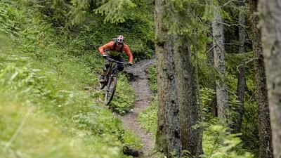
Almost all sections of the Wutach Gorge are inaccessible to mountain bikers, except for this version. The trail rides along the Reichenbächle stream down into the Wutach Gorge and continues along the Wutach to Schattenmühle. For the most part, the trail remains at S1 level, with short descents in some places, for example at root sections or short climbs. The trail is easy to ride on a mountain bike, but requires a very considerate riding style, as there are also many hikers on the trail. Hikers in this area are often conservative when it comes to sharing the paths. Driving in the Wutach Gorge should therefore be avoided at weekends or in the high season. It is also advisable for mountain bikers to ride individually or in pairs and not in larger groups.
Note: The tour is located in Baden-Württemberg with the legal requirement of a two-meter rule. This tour contains elements that do not comply with this regulation. Rather, it reflects routes that are ridden by local mountain bikers. Compliance with the regulations is the responsibility of each individual mountain biker.
Map & GPX-Track
The map is only available to Ride subscribers.
The Ride-Subscription is available at ride-mtb.com/abo
.
Details of the tour
39 km
670 m
670 m
672 above sea level
1035 above sea level
1 day
Bonndorf
Bonndorf
3015
well suited
More information
More tours nearby




User comments (0)

About the author: Thomas Giger
Note: This content has been automatically translated from German. Please report any incorrect translations.