

Höchenschwander Felsenweg

Description
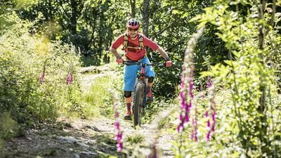
Sankt Blasien is the starting point for the route. The tour could also be started in Höchenschwand, but from Sankt Blasien there is a special load of trails. One begins right after the start on the edge of the village of Sankt Blasien. In a mixture of trails and gravel roads, you reach the Gasthof Albtalblick and later the village of Höchenschwand. This is the starting point of the long singletrail descent on the Felsenweg, which begins right at the southern edge of the village. A fast, flowing trail leads through the forest, never steep, never tricky. Then the trail changes into a style that is otherwise familiar from the Suonen in Valais. It hugs the steep terrain. It rides along a rocky ledge for around 50 meters. Less experienced mountain bikers push a few meters here. Then it becomes smoother again and this is how you reach the Fohrenbachsäge, the lowest point of the tour. In total, this is a super trail over seven kilometers long. However, this requires a considerate riding style, as it is marketed as a hike as the "Wolfsweg".
From the Fohrenbachsäge, you head up to Oberweschnegg on gravel roads along the Fohrenbach and continue on country roads back to Höchenschwand. Behind the football pitch, the descent starts down to Sankt Blasien, a mixture of single trails and gravel sections. This takes you to the Albstausee reservoir and back to the starting point on easy trails.
Note: The tour is located in Baden-Württemberg with the legal requirement of a two-meter rule. This tour contains elements that do not comply with this regulation. Rather, it reflects routes that are ridden by local mountain bikers. Compliance with the regulations is the responsibility of each individual mountain biker.
Map & GPX-Track
The map is only available to Ride subscribers.
The Ride-Subscription is available at ride-mtb.com/abo
.
Details of the tour
29 km
780 m
780 m
605 above sea level
1018 above sea level
1 day
Sankt Blasien
Sankt Blasien
2472
well suited
More information
More tours nearby







User comments (3)

About the author: Thomas Giger
Note: This content has been automatically translated from German. Please report any incorrect translations.
Rode on June 30, 2026, but in a shortened version with a quick drive from Switzerland. Parked at the lowest point in Fohrenbachsäge, and in Höchenschwand, instead of heading to St. Blasien, I went straight onto the Felsenweg. This results in a nice concave elevation profile ;-) and 20 kilometers with 500 meters of elevation gain. Unfortunately, the last 100 meters of elevation loss were closed at the time due to forestry work. On the other hand, there was only one dog walker and no other hikers on the entire Felsenweg.
There were always trees lying across the rocky path and it was very overgrown, so not sooo smooth 😀
The rocky path is really very nice, as is the following trail. Early in the morning in April there were almost no hikers. In very nice weather & a little later in the day with lots of people, rather not recommended.