

Stepberg - Gelbes Gwänd

Description
From the train station in Garmisch-Partenkirchen, you wind your way through the town and along a moderately steep tarred road to the idyllic Pflegersee lake. From here, follow the forest path, which climbs steadily from the humpbacked Reschbergwiesn towards Enningalm. After a short descent, a narrower path on the right leads to the partially managed Enningalm. Follow the path across the meadow and leave the left fork behind. Now about 200 vertical meters of trail fun await, mostly at S1/S2 level, only at the beginning is the path a little exposed. At the end of the trail, you meet the ascent from the Enningalm and follow the cart path steeply to the left up the mountain. The following 350 vertical meters up to the Stepbergsattel are quite a challenge. Once you reach the top, you roll comfortably down to the Stepbergalm, which is serviced and offers great views.
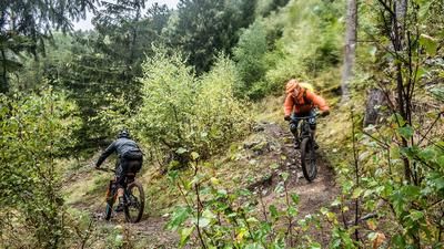
After a rest, follow the narrow Gelbes Gwänd trail on the right down across the meadows. (Alternatively, turn left onto the Way of the Cross, see Tour Way of the Cross 2492.) The path winds its way down over root passages, steps and hairpin bends at S2/S3 level until it breaks off into a kind of ravine. This is followed by a steep wooden staircase and a number of challenging hairpin bends that trial specialists will enjoy. In between, there are always flowing passages and magnificent views of the Zugspitze massif. At the end of the trail, you come to a cart path that leads down to the Kramerplateau and on to Garmisch.
Note: The area around the Stepbergalm is particularly busy with hikers at weekends, so rush hours should be avoided on the descent.
Alternative ascent: The tour can also be ridden via the Rotmoosalm without an additional ascent instead of via the Enningalm. See tour Kreuzweg 2492.
Map & GPX-Track
The map is only available to Ride subscribers.
The Ride-Subscription is available at ride-mtb.com/abo
.
Details of the tour
31 km
1235 m
1235 m
687 above sea level
1662 above sea level
1 day
Garmisch-Partenkirchen
Garmisch-Partenkirchen
2515
limited
More information
More tours nearby








User comments (1)
Note: This content has been automatically translated from German. Please report any incorrect translations.
Very nice tour and very well described (very accurate from my point of view)!
A little tip about the ascent to Pflegersee: take the road rather than the hiking trail. There are explicit MTB prohibition signs there and the coexistence of MTB hikers is difficult in Garmisch anyway... ;-).