

Compietto

Description
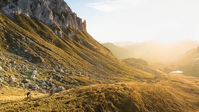
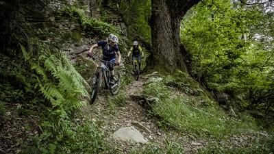
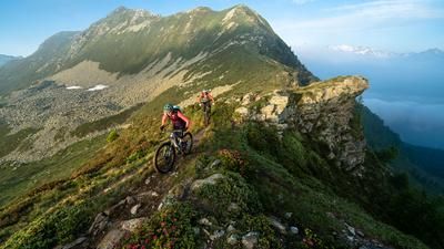
The tour begins spectacularly with the ascent on the old gorge path from Olivone up to Campo. Here you branch off to the right and climb up a small road to the dam wall of Lago di Luzzone. The ascent continues on the opposite side of the wall, passing through two tunnels, and at Passo Muazz you have completed the 800 meters of ascent from Olivone. The route now descends to Compietto, a typical Ticino mountain village with lovely stone houses and the roofs of the Schifers. Now the singletrail descent begins! It initially leads along the mountain path to Garnàira and then down through the steep forest to Olivone. Although you have to descend a few times here, the trail is generally fun and much more flowy than most of the other trails in the Blenio Valley and Sopra Ceneri. The descent starts right on the outskirts of Olivone.
Map & GPX-Track
The map is only available to Ride subscribers.
The Ride-Subscription is available at ride-mtb.com/abo
.
Details of the tour
17 km
945 m
945 m
885 above sea level
1792 above sea level
1 day
Olivone
Olivone
1529
well suited
More tours nearby




User comments (9)

About the author: Thomas Giger
Note: This content has been automatically translated from German. Please report any incorrect translations.
Claire described it perfectly. That’s exactly how it is. As of now (July 12, 2026), some kind souls have cleared the trail along the entire upper section of the slope crossing from Cumpiett to Alp Garnaira, where it transitions into the downhill section. It was rideable (and pushable) within the limits of our personal abilities, but still a bit of a struggle due to the constant ups and downs on the steep slope—though above all, it was manageable and finally over. It didn’t take us 10 minutes; more like 20. It’s less about your calves and more about how quickly your brain can process what’s in front of you. The switchback downhill has more of a Lake Garda vibe with a bit of a rumble than what you’re usually used to in this area. All in all, not the best ride in the area, but not bad either.
For those who are curious and want to know exactly how the tunnel through the dam came to be: The dam used to be lower. When they raised the dam by 20 meters, they simply encased the old crest path in concrete to form a tunnel. You can also ride across the top of the dam on the new crest path and then carry your bikes down a steel staircase to the old level (where the trail continues). And the trip back in time during your restaurant visit offers a live glimpse into the world of your parents or even grandparents (depending on the age group of the riders).
A beautiful hike around the Sosto. The ascent begins by winding through a breathtaking gorge. This is followed by a longer stretch along the road up to the dam. The restaurant above the dam is highly recommended—even if it has a strong ’60s vibe. You then ride through the dam via a tunnel and continue uphill a bit further, where a second tunnel follows. After that, the first downhill section begins, which is very pleasant and fairly easy to ride. Later, there’s a short climb where you’ll have to push your bike for a bit. The descent that follows is quite overgrown in places and apparently isn’t ridden very often. Nevertheless, it’s very interesting to ride, with exciting technical sections popping up every now and then. We had pretty wet weather, which made the rocks and roots very slippery—that made the tour even more challenging. 98 percent of the route is rideable. Overall, the tour comes highly recommended—the Blenio Valley absolutely delivered!
Claire
I tend to agree with the previous comments - and not the last one. The descent is easy except for a short section to Cumpiett and the tough 10 minutes to just before 1540. However, the descent is sometimes gravely and steep but also has many beautiful and fast sections.
We did Sole, Cantonill and this descent on the same day and we all thought that although this descent was beautiful, it was somewhat less rewarding than the descent from Cantonill via Scandorair and also from Sole.
Very nice tour, especially the uphill. Something different with the dam wall and the tunnels.
In the upper part of the downhill I was a bit relaxed up to the house at point 1540. The trail is quite overgrown, narrow and on the right it just goes downhill in places... blind flight and exposed sections don't quite go together for me.
After that, the trail is very nice with some - relatively easy - technical sections.
Almost everything is rideable uphill. Spectacular scenery and a special experience riding THROUGH the dam wall.
The descent is initially flowy across meadows. Then a constant up and down along the contour line before a steep and sometimes technical descent. All in all a wonderful tour!
Super nice tour, as described by David Winistörfer on June 9, 2020, after Compietto the path is a steady up & down for about 10min. But the DH afterwards is really very nice. It's strange that this trail/path is not marked on the singletrail map.
We agree with David Winistörfer's comment. My partner and I were able to ride the descent continuously except for a few places.
I rode the tour on June 3, 2020. Only got on the route in Campo Blenio as I had a date with the Croce Portera and the Cap. Bovarina had. The climb to the dam wall and then to Passo Muazz is easy to ride. The first downhill to Compietto is then quite difficult but, apart from a few passages, easy to ride. After the village, the route leads through the forest onto a beautiful high-level trail. However, the joy is short-lived... there are always blocked sections and sometimes steep counter-climbs that force you off your bike at short intervals. However, the whole thing only takes about 10 minutes until you reach Alp Garnaira. In addition, you have hardly "destroyed" any vertical meters up to the alp. From there, the downhill begins, which I was able to ride completely except for two passages. The trail is a soft forest trail with roots and only gets a little rocky and rough at the very end. However, the trail is very steep throughout and I was glad of my good brakes and plus-size tires. The trail was just right for my abilities so that I could still have fun riding it.
I ride a Scott Genius Ultimate and am usually in the head group uphill; downhill I'm always last, by a long way.
See my comment at "Capanna Adula". Over 60% of the downhill from the Alp is not rideable even for good bikers!