

Croce del Serva

Description
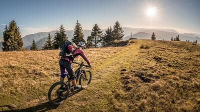
The route starts in the village of Ponte nelle Alpi. Stricken by the Vajont disaster in the 1960s, some parts of this village were rebuilt. From here, the route follows the cycle path to the district of Cusighe. The route now continues on asphalt and gravel to the crossroads below San Micel. On a moderate gradient, the uphill ride takes you past the Rifugio Col die Roanza and then extremely steeply on gravel up to an altitude of around 1200 meters above sea level to the viewpoint and thus the highest point of the tour. It should be noted that the last few meters can only be ridden by fit biobikers or e-bikers.
From the clear area, the route then follows a fantastic single trail over 800 Elevation loss back to the starting point. A technical trail treat with all the extras. From flow to hairpin bends, rock gardens and typical surface conditions for the region, this descent has it all. At difficulty level S2, in places S3, the route climbs to an altitude of around 700 meters above sea level. You then cross a fairly flowy trail and then take the final downhill on a fantastic section of forest back to Ponte nelle Alpi.
Map & GPX-Track
The map is only available to Ride subscribers.
The Ride-Subscription is available at ride-mtb.com/abo
.
Details of the tour
20 km
790 m
290 m
376 above sea level
1146 above sea level
1 day
Ponte nelle Alpi
Ponte nelle Alpi
2533
well suited
More information
More tours nearby




User comments (0)

About the author: Martin Depauli
Note: This content has been automatically translated from German. Please report any incorrect translations.