

Monte Serva

Description
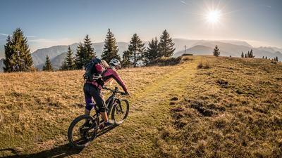
The route starts in the village of Ponte nelle Alpi. From here, the cycle path winds its way along the main road Via Caduti 14 Settembre1944 to the district of Cusighe and continues steadily up the idyllic mountain slopes to Col di Roanza. In between, the path is relatively steep, which means you gain a good few meters in altitude. From Col di Roanza, the path becomes steeper and rougher, before you finally leave the bike at an altitude of 1100 meters above sea level and carry the bike up to the summit over 1000 meters in altitude. This relatively long distance is covered by pushing and carrying the bike. The reward: from around 1500 meters above sea level, a breathtaking panorama and, at the summit, probably one of the best views in the entire Alpine region. The views to the south, towards Belluno and the Piave River, as well as to the Mediterranean Sea and the Dolomites to the north leave nothing to be desired.
The descent also leaves nothing to be desired. At difficulty levels S2 to S3, it is an uninterrupted 1000 Elevation loss to the former carrying point. A downhill that is second to none. Perfectly laid out hairpin bends with flow passages alternate with technical sections. In the area of the gravel road, you then take the path towards Bait del Piciol and follow it across to the starting point. Initially at difficulty levels S2 to S3, it becomes increasingly easier and finally changes to a pure flow trail with difficulty level S1. All in all, an eternal descent with 1700 Elevation loss, which is demanding in terms of fitness and technique, but an absolute classic.
Map & GPX-Track
The map is only available to Ride subscribers.
The Ride-Subscription is available at ride-mtb.com/abo
.
Details of the tour
24 km
1695 m
1695 m
376 above sea level
2060 above sea level
1 day
Ponte nelle Alpi
Ponte nelle Alpi
2377
not suitable
More information
More tours nearby




User comments (0)

About the author: Thomas Giger
Note: This content has been automatically translated from German. Please report any incorrect translations.