

Croda Nera

Description
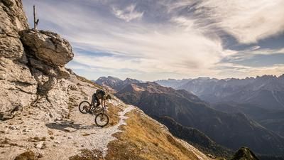
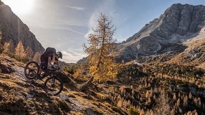
The ride starts in Cima Canale, a hamlet of Santo Stefano di Cadore. Here, you begin on asphalt and later switch to gravel as you climb an epic military road dating back to World War II, leading up to the Tilliacher Pass—or Forcella Dignas—at 2,094 meters above sea level. The views of the Porze and the Carnic Alps from this vantage point are in a class of their own. In the upper section, you’ll also find military installations from World War II—part of the “Vallo Alpino”—as well as from World War I. Afterward, you’ll carry your mountain bike along the ridge for a total of just under 400 meters of elevation gain to Croda Nera at 2,431 meters above sea level. The view is absolutely breathtaking, stretching from the Grossglockner over the Hohe Tauern to the Belluno Dolomites.
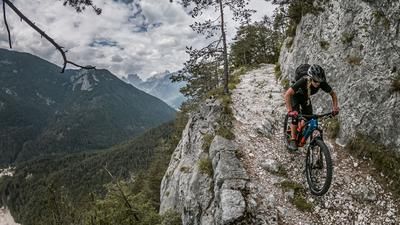
The descent begins at difficulty levels S2 and S3 and remains at this level before reaching Croda Nera. You then traverse several exposed sections, similar to those encountered on the ascent to Croda Nera, with the rideable sections rated at difficulty level S2. After the Col del Rocco, you finally take the descent route toward Malga Cecido. The route continues by crossing the high-altitude trail toward Casera de le Drotele, with an approximately 100-meter climb, and then follows Sentiero 128—at difficulty level S2 and occasionally S3—steadily downhill to Costa d’Antola. From there, you ride back on asphalt to the starting point.
All in all, this is a very impressive, alpine, and challenging tour that requires sure-footedness and alpine experience during the ascent, as two sections are briefly secured with ropes. Furthermore, please note that logging operations are still underway in this area due to the severe windthrow from 2018, which may cause trails to be temporarily closed or obstructed.
Map & GPX-Track
The map is only available to Ride subscribers.
The Ride-Subscription is available at ride-mtb.com/abo
.
Details of the tour
26 km
1240 m
1240 m
1260 above sea level
2368 above sea level
1 day
Santa Stefana di Cadore
Santa Stefana di Cadore
3734
not suitable
More information
More tours nearby





User comments (0)

About the author: Martin Depauli
Note: This content has been automatically translated from German. Please report any incorrect translations.