

Cima Ombladet - Sentiero 141

Description
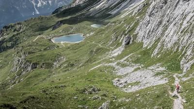
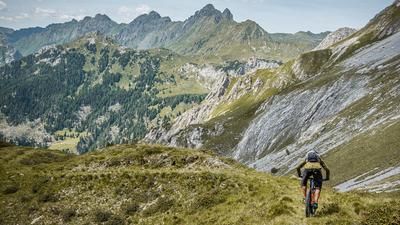
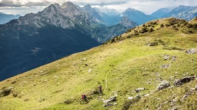
The route starts in the village of Forni Avoltri. From here, you wind your way uphill on asphalt along the main road towards Frassenetto at a moderate gradient. In Frassenetto, at just under 1100 meters above sea level, you change to a forest road and follow it uphill to around 1600 meters above sea level. A magnificent view of the surrounding mountains opens up in a somewhat sleepy area. The view of the Belluno Dolomites makes up for the climb so far. The route continues relatively well uphill to the Casera Monte dei Buoi. From this point, you are above the tree line and push or carry your bike up to the summit of Cima Ombladet (2255 meters above sea level). A few fragments from the First World War can still be found at the summit. Beyond that, the panorama is deluxe. Lake Wolay is within reach, to the north you have a view of the entire Carnic main ridge, and to the south of the Tagliamento, Tolmezzo and the Mediterranean. Especially in the fall and spring, you can also see as far as the Grossglockner to the north. This gives you one of the best panoramic views of the Alps that you can find here.
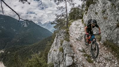
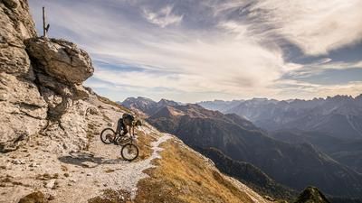
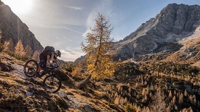
The enjoyment of the tour begins now. In the upper section, the downhill runs along the ascent variant over the ridge. The route then continues on an Alpini trail to the Forcella di Ombladet. Directly below the Wolayer Kopf, you now take the 141er-Sentiero towards Casera Chiampei. A fantastic trail with a difficulty of S2, in places S3, winds its way down to Collina/Collinetta. It is unimaginable what energy was expended back then to build these wartime paths and what trail gems they have mutated into in the meantime. From Collinetta, you then roll back along the asphalt road to Sigilletto as a transfer and from here the last trail section begins. At difficulty level S2, in places S3, the route leads back to Forni Avoltri.
Tip: At Sigilletto, be sure to check whether there are any wood skins and thus existing trail closures, as storm damage has repeatedly occurred in recent years due to strong winds.
Map & GPX-Track
The map is only available to Ride subscribers.
The Ride-Subscription is available at ride-mtb.com/abo
.
Details of the tour
23 km
1450 m
1450 m
807 above sea level
2164 above sea level
1 day
Forni Avoltri
Forni Avoltri
2405
not suitable
More information
More tours nearby







User comments (1)

About the author: Martin Depauli
Note: This content has been automatically translated from German. Please report any incorrect translations.
I rode the tour on 15.08.24. Pleasant ascent to the Casera Monte Buoi. The rest of the climb with carrying the bike is a bit of a drag.
But you are always rewarded with a magnificent panorama!
A few comments on the trail, which is currently only worthwhile to a limited extent:
- Wonderful trail up to Forcella di Ombladet with a counter-climb.
- Up to about 1800m the trail is heavily eroded or no longer really exists
- Over the rest of the trail to Collina you just fly over it :) Wonderful. Sometimes difficult to find the way due to the vegetation
- After the short section of trail to Sigiletto up to approx. 980m, the trail is no longer there. I looked for it in the bushes but there is no more trail. You have to take the forest road back to Frassenetto and roll back to the starting point on asphalt.
A technically rewarding tour in terms of scenery and panorama. However, parts of the trail are currently in poor condition. But that can happen in the Alps, we're not in a bike park after all.