

Monte Crostis

Description
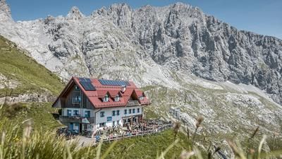
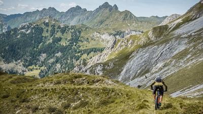
The starting point is the village of Margo just above Comeglians. From here, the route climbs steadily uphill on asphalt and later on gravel through a military facility in Vallo Alpino. The signposts to Monte Crostis show the gradient, altitude and current data for the ascent. You will be rewarded for this long and challenging ascent with great views and breathtaking vistas of the Carnic Alps. Above the Casera Chiadins alta, you then push up to the summit on Sentiero 151. Some sections can still be climbed on foot, but these are limited. At the summit of Monte Crostis, you reach an altitude of 2250 meters above sea level. Formerly a heavily contested mountain in the First World War and a fortified mountain in the Second World War through the Vallo Alpino, it is therefore perfectly accessible and also offers a varied trail descent. At difficulty level S2, occasionally S3, the route leads along the ridge, later through forests to the small village of Givigliana. It should be noted that in the summer months in particular, the meadow areas are somewhat overgrown and the search for the trail can become more intense. Once you arrive in Givigliana, you pass through the small village, where you can also fill up with drinking water. The route then descends on S1 to S2 to the main road. A spectacular downhill on a historic mule track. From here, you then take the road to finally reach the starting point.
Map & GPX-Track
The map is only available to Ride subscribers.
The Ride-Subscription is available at ride-mtb.com/abo
.
Details of the tour
29 km
1700 m
1700 m
565 above sea level
2210 above sea level
1 day
Comeglians
Comeglians
2746
well suited
More information
More tours nearby





User comments (0)

About the author: Martin Depauli
Note: This content has been automatically translated from German. Please report any incorrect translations.