

Latschenhütte

Description
The start is in Imst. The route first rides a few meters on asphalt, then on gravel through wooded areas steadily uphill towards Speichersee Hoch Imst. Past the lake, the route continues uphill to the Untermarkter Alm and then along the lift route to the Latschenhütte. This is the ideal place to stop for refreshments as it also marks the highest point of the tour.
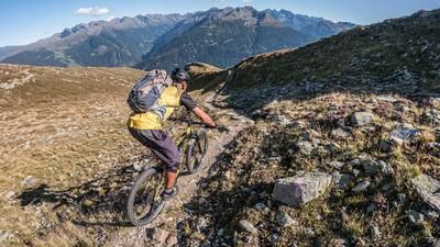
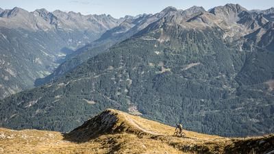
The end of the valley with the Scharnitzsattel saddle at the highest point is an impressive landscape and also offers a wide view to the west over the Oberinntal valley. At the Latschenhütte hut, you could alternatively take the Jägersteig trail along the Malchbach stream, but this is very challenging and very bumpy. We therefore recommend the descent on the Opferstockweg, which you reach after a short gravel section. The trail essentially follows an old cart path or mule track and leads steadily downhill on difficulty S1, in places S2.
Finally, you reach urban terrain again via the settlement area of Imst and roll the last few meters comfortably back to the starting point of the tour.
Note: The route is located on Austrian territory and leads over routes that are not approved for mountain bikers. Riding this route on a mountain bike is the responsibility of each individual, in full awareness of the legal situation.
Map & GPX-Track
The map is only available to Ride subscribers.
The Ride-Subscription is available at ride-mtb.com/abo
.
Details of the tour
33 km
830 m
830 m
782 above sea level
1618 above sea level
1 day
Imst
Imst
3599
well suited
More information
More tours nearby


User comments (0)

About the author: Martin Depauli
Note: This content has been automatically translated from German. Please report any incorrect translations.