

Wankspitze

Description
The tour starts directly in Obsteig on the Mieminger Plateau. From here, a relaxed gravel path rides through Swiss stone pine and spruce forests along the official cycle route towards Lehnberghaus. From around 1250 meters above sea level, the path becomes somewhat steeper and more challenging, but remains easy to ride. Shortly before the Lehnberghaus, turn right and follow the forest road that rides to the last few meters before the summit of the Wankspitze.
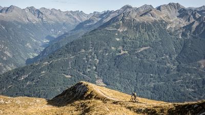
From here, the forest path ends and the bike has to be pushed or carried. The trail continues to the Lacke viewpoint, where a special construction perfectly frames the impressive mountain panorama. From here, you work your way up step by step along the ridge. The climb is long and requires stamina. At the top of the Wankspitze, you are rewarded with a panoramic view of the Mieminger Kette and the surrounding mountain panorama.
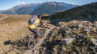
The descent from the summit cross to the Lacke viewpoint is at difficulty level S2, with only a few S3 sections. The most difficult section is the summit area over the somewhat exposed grade. After that, the section is easy to ride. At the Lacke viewpoint, you have two options:
- Heading south via a trail marked as "difficult" with a red sign.
- About the Lehnberghaus, a technically easier route that remains at difficulty level S2 throughout.
The trail heading south (variant with GPS track) from the viewpoint, on the other hand, has S4 sections. Advanced technique is a must here: shifting the rear wheel and negotiating tight hairpin bends with roots and stones are the order of the day. This section should only be ridden in absolutely dry conditions. There are also some passages here that are better ridden by pushing. After around 200 to 300 meters in altitude at this level of difficulty, the trail gradually becomes easier and changes to S1 via S3 and S2. The end of the tour leads through the relaxing southern slopes before you finally return to Obsteig.
Note: The route is located on Austrian territory and leads over routes that are not approved for mountain bikers. Riding this route on a mountain bike is the responsibility of each individual, in full awareness of the legal situation.
Map & GPX-Track
The map is only available to Ride subscribers.
The Ride-Subscription is available at ride-mtb.com/abo
.
Details of the tour
16 km
1150 m
1150 m
984 above sea level
2145 above sea level
1 day
Obsteig
Obsteig
3377
not suitable
More information
More tours nearby


User comments (1)

About the author: Martin Depauli
Note: This content has been automatically translated from German. Please report any incorrect translations.
I just reached the summit on my e-bike. So it's not true that the route isn't suitable for e-bikes. Other than that: a great ride!