

Loreakopf

Description
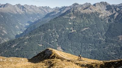
The tour starts at the Romantik Camping Fernsteinsee, whereby the ascent is not very romantic, but rather steep and challenging. At first, the route is relaxed and uphill on gravel with a homogeneous surface. From around 1400 meters above sea level, however, the picture changes: from here, the bike has to be mainly pushed or carried. Steeply along the Hainbach stream, you gain altitude meter by altitude meter until you reach the Loreascharte. From there, you already have an impressive view of the Loreakopf. The views in this high alpine terrain are breathtaking, especially the slope crossing in the upper section. From the saddle, every biker has to decide for themselves how far they want to carry their bike towards the summit. Many passages are not rideable. The summit is extremely isolated and offers a spectacular all-round panorama that is unforgettable in good light conditions.
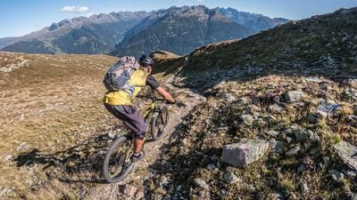
The descent begins directly at the summit and initially runs along the exposed ridge. Clean riding technique and good pedal management are essential here. The difficulty is classified as S3 to S4 and the trail requires absolute concentration. From the Loreascharte, the trail becomes a little less exposed, but remains technically demanding (S3+). Loose gravel passages and tight bends demand precise line choice and a high level of riding technique. At the Loreahütte, a self-catering hut, you can replenish your water supplies before setting off on the long and varied downhill towards Fernsteinsee. This section combines flowing passages with crisp technical challenges and key sections that make the trail extremely varied and rewarding. Finally, you reach the valley floor again near the Fernsteinsee lake and complete the tour. All in all, a very alpine tour that requires you to take responsibility for how far you carry your bike or where you set up a bike depot at the summit, but is very inviting for fit and technically-minded riders.
Map & GPX-Track
The map is only available to Ride subscribers.
The Ride-Subscription is available at ride-mtb.com/abo
.
Details of the tour
16 km
1460 m
1460 m
915 above sea level
2383 above sea level
Fernsteinsee
Fernsteinsee
3381
not suitable
More information
More tours nearby


User comments (0)

About the author: Martin Depauli
Note: This content has been automatically translated from German. Please report any incorrect translations.