

Nassereither Alm

Description
The tour starts west of Nassereith. First, it is a relaxed uphill ride on a gravel road to the Fernsteinsee lake. There you come across the old Roman path at Fernstein Castle. This section rides evenly and pleasantly uphill, with a short section below the Schanzlsee lake on a narrow trail with historical structures. Caution is advised here, as there may be oncoming traffic.
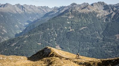
The route continues idyllically through larch and spruce forests away from the busy Fernpass road. Finally, you reach the fork in the Via Claudia Augusta, where you take the uphill towards the Nassereither Alm. On a well-maintained gravel road with a moderate gradient, you continuously gain altitude until you reach the highest point of the tour at almost 1750 meters above sea level. The Nassereither Alm invites you to take a break and offers a fantastic mountain panorama on its sun terrace - an ideal place for a short rest before the descent begins.
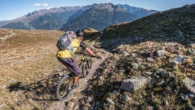
The descent starts on the Kaswasserweg, also known as the Gipssteig. Initially, you roll comfortably across a meadow, but the trail soon changes to a typical alpine climb. The trail is peppered with hairpin bends, roots and loose limestone, which makes it technically challenging. The difficulty lies between S2 and S3, with some key sections requiring a clean riding technique. Riders who have mastered the technique of shifting into hairpin bends and have a solid braking technique will find an exciting challenge here. The trail rides steadily downhill and ends almost directly at the starting point of the tour. From here, it is only a few meters on gravel to get back to the starting point.
Note: The route is located on Austrian territory and leads over routes that are not approved for mountain bikers. Riding this route on a mountain bike is the responsibility of each individual, in full awareness of the legal situation.
Map & GPX-Track
The map is only available to Ride subscribers.
The Ride-Subscription is available at ride-mtb.com/abo
.
Details of the tour
18 km
890 m
890 m
863 above sea level
1730 above sea level
Nassereith
Nassereith
3376
well suited
More information
More tours nearby


User comments (0)

About the author: Martin Depauli
Note: This content has been automatically translated from German. Please report any incorrect translations.