

Monte Sagran

Description
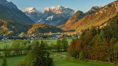
The tour starts in the idyllic village of Ugovizza and rides steadily uphill on a historic road through the Valle di Ugovizza. Surrounded by gentle mountain hills and rugged rock formations, you pedal at a medium to moderate gradient up to the Kalten Brunnen, where the path branches off to the Sagranberg/Monte Sagran. From around 1700 meters above sea level, you have to push your bike until you reach the highest point of the tour at 1931 meters above sea level. A small summit cross marks the peak, which drops steeply to the south. The view extends far over the Gailtal valley, Lower Carinthia, the Kanaltal valley and the Julian and Carnic Alps and is an absolute highlight, especially in autumn.
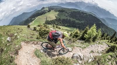
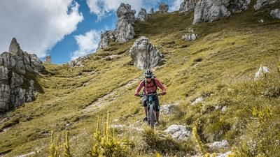
The descent rides north and is classified as difficulty level S2. The route descends through dense spruce forests on forest floor, with some narrow passages requiring particular caution, especially with regard to the derailleur. After reaching the Dolinza Alm, you cross the state border into Italy and ride past the Rifugio Nordio-Deffar on an unspectacular forest road back into the Valle di Ugovizza. In the area of the chapel, the path branches off to the right and leads up to the start of the Rio Rauno Trail. This last trail section is graded S1 to S2, but has an adventurous character with a slight cross-country profile. There is a risk of falling at some of the secured sections, which is why particular caution is required here. The loop ends back in Ugovizza.
For e-bikers, please note that there is a short push section of around 200 vertical meters from the Forcella di Fontana Fredda to the summit. With a little skill and determination, this section is also easily manageable.
Note: The route is located on Austrian territory and leads over routes that are not approved for mountain bikers. Riding this route on a mountain bike is the responsibility of each individual, in full awareness of the legal situation.
Map & GPX-Track
The map is only available to Ride subscribers.
The Ride-Subscription is available at ride-mtb.com/abo
.
Details of the tour
21 km
1150 m
1150 m
779 above sea level
1876 above sea level
Ugovizza
Ugovizza
3408
limited
More information
More tours nearby





User comments (0)

About the author: Martin Depauli
Note: This content has been automatically translated from German. Please report any incorrect translations.