

Monte Nebria - Malga Rauna

Description
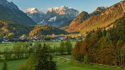
The tour starts near Malborghetto, a picturesque village at the upper end of the Canal Valley, close to the Fella river. The ascent begins on asphalt and gravel and rides to Monte Nebria, a mountain that was heavily fortified during the First World War and today offers a perfectly laid out military road for mountain bikers. This rides all the way to the summit, where nature has begun to reclaim it in some places and the road is partly silted up or filled in with gravel. From Monte Nebria, you have a great view of the upper Kanaltal valley and the state border between Italy and Austria.
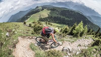
The downhill to the west starts invitingly and is classified as difficulty level S2. You descend through beech forests on forest floor with a combination of hairpin bends until you finally reach the main forest road again. Here you can visit some of the Vallo Alpino facilities before the next ascent to Malga Rauna begins. On asphalt and gravel, you climb almost 1500 meters above sea level and plunge into the next downhill, which is also classified as S1 and S2 and rides through typical beech forests of the region. There may be occasional trees or erosion damage in this area, as it is exposed to strong storms and squalls.
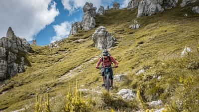
The ascent to Monte Nebria then begins again, with the eastern summit being reached with some pushing and carrying before the east-west descent with difficulty level S3 rides back to the starting point. In total, this tour offers three ascents and three descents, which can be individually tailored. Almost the entire tour can be completed on an e-bike, although the north/east variant in the summit area is only suitable for e-bikes to a limited extent due to a pushing passage. In addition to the sporting challenges, there are countless Vallo Alpino and First World War installations to explore in the area, so it is advisable to pack a flashlight.
Map & GPX-Track
The map is only available to Ride subscribers.
The Ride-Subscription is available at ride-mtb.com/abo
.
Details of the tour
22 km
1330 m
1330 m
754 above sea level
1542 above sea level
1 day
Malborghetto
Malborghetto
3210
limited
More information
More tours nearby





User comments (2)

About the author: Martin Depauli
Note: This content has been automatically translated from German. Please report any incorrect translations.
October 1, 25 ridden: beautiful, strenuous tour, my Hm spit out 1550 hm, Nebria S3 here means very narrow path in steeply sloping terrain, partly covered by grass, with countless switchbacks...but if you can handle it, you'll have fun. Malga Rauna some steep ramps up, which I pushed and down partly steep and more difficult due to wetness. But all in all a great lonely corner.
Our BnB is located about 60 minutes by car from the starting point of this tour and directly on the trail area of Gemona of Friuli.
https://www.bnb-bondigemona.ch/