

Rechelkopf

Description
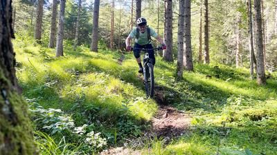
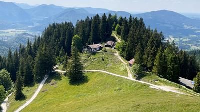
You ride from Bad Wiessee via Sonnbichl up the steep forest road to the Aueralm. If you want to take it easy, you can stop off here. Otherwise, turn right across the meadow into the forest. You have to look for the old, not often frequented trail and use the GPS track to find your way. Progress in the forest is very slow. By pushing, you follow the trail track, which you will always find. In the sloping terrain, you come across an old, overgrown forest road and continue to ride uphill until you reach the top of the ridge and meet the trail again. Unfortunately, the grass is very high in summer and it is quite a search. Many fallen trees don't make it any easier either. From now on, the trail goes slightly downhill and you can orientate yourself at the border fence (barbed wire fence) Bad Wiessee/Gaissach. You always ride or push along the fence until you reach a hunting lodge near the Luckenkopf.
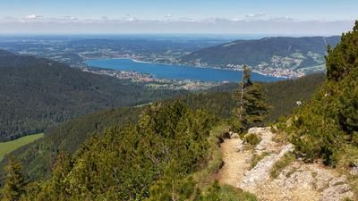
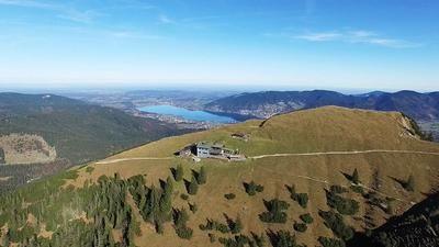
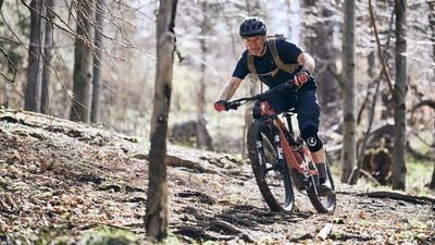
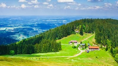
Leave the hunting lodge on the left and ride downhill on the flowing trail. However, the trail soon disappears again and you are once more guided by the border fence. Now comes another steep pushing section until you soon reach the Rechelkopf near the Gronetseck and the Sigirzalm. From here you have a wonderful view of the Benediktenwand and the Alpine foothills. The search is over. From now on, it's all about shredding trails. Ride along the wide trail until you reach the Greiling sign. Here you turn left onto the trail, which repeatedly crosses the forest road. The long technical trail leads to the crossroads, which you ride to the right towards Mariastein. In Mariastein, the forest road on the right goes very steeply up to the unmanaged Holzeralm. Now the Holzerralm trail begins, which is very rooty and steep in places and leads down to Bad Wiessee. Above Bad Wiessee, you finally ride back towards Sonnbichl to the starting point.
Map & GPX-Track
The map is only available to Ride subscribers.
The Ride-Subscription is available at ride-mtb.com/abo
.
Details of the tour
34 km
1540 m
1540 m
717 above sea level
1402 above sea level
1 day
Bad Wiessee
Bad Wiessee
2521
limited
More information
More tours nearby












User comments (0)
Background to Ride MTB
Ride MTB is dedicated to mountain biking. With the maps Ride Trail Maps and Trail Books and the print magazine Ride, it has played a formative role in alpine mountain biking for many years and has shaped it like few other organizations.
In addition to the publishing business, the company is now also active in product management and operating entire mountain bike projects. These include the tourism project Ride Travel and the development of modern and authentic mountain bike offers such as the Bahnentour in Davos Klosters, Engadin St. Moritz, Lenzerheide or Aletsch, as well as the creation of multi-day tours such as the Postauto-Tour or the Hüttentour.
Ride MTB GmbH was founded in 2001 (formerly Swiss Sports Publishing GmbH) and has been owned and managed by Thomas Giger since then.
Publishing and editorial address
Ride MTB GmbH
Falladagasse 11
CH-7212 Seewis
+41 81 413 43 43
info@ride-mtb.com
Subscription management
Advertisements
Administration
Bank details: Graubündner Kantonalbank.
CHF account. IBAN: CH86 0077 4010 2958 8310 1, BIC: GRKBCH2270A
EUR account. IBAN: CH32 0077 4010 2958 8310 3, BIC: GRKBCH2270A
Company identification number (UID): CHE-102.170.292
The brains behind Ride MTB










Note: This content has been automatically translated from German. Please report any incorrect translations.