

Tracciolino

Description
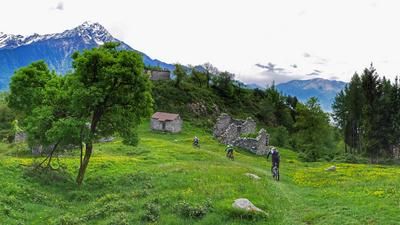
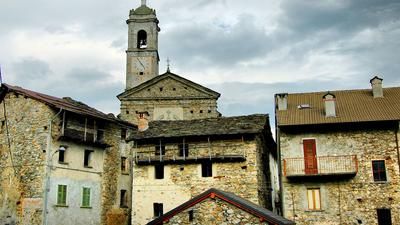
The route to the Tracciolino Trail usually starts in Verceia on Lago di Mezzola and initially rides up the road almost to Casten. Just before the village you reach a small railroad line - this is the start of the Tracciolino Trail. The small railroad connects the reservoir in Valle di Ratti with the water pipes down to the power station. Follow the tracks and then turn right at a tunnel. It is recommended that you carry a flashlight. The Tracciolino now rides through the rocky terrain in tunnels and rocky paths through what is actually inaccessible terrain. As a rule, the path is secured with wire ropes on the outside, and driving along the path is no technical feat - but it is an impressive experience. Above the village of Ci, you have to descend on a trail and push your bike back up to Codera on the other side. The trail would actually continue up through additional tunnels, but these have collapsed. However, the effort of pushing the bike up to Codera is worth it. There are two first-class grottos here! The return journey follows the same route, replacing the asphalt road to Verceia with the first-class singletrail that runs parallel to it down to the village.
The trail from Codera to Novate Mezzola is not suitable as a descent, it is too difficult and only reasonably rideable in a few places.
Note: The Tracciolino is currently closed as parts of the trail have slipped and there is a risk of falling rocks. Nevertheless, the trail is still used by hikers and bikers.
Map & GPX-Track
The map is only available to Ride subscribers.
The Ride-Subscription is available at ride-mtb.com/abo
.
Details of the tour
28 km
700 m
700 m
204 above sea level
1051 above sea level
1 day
Verceia
Verceia
1310
limited
More information
Video
More tours nearby











User comments (8)

About the author: Thomas Giger
Note: This content has been automatically translated from German. Please report any incorrect translations.
Website of the municipality of Verceia from 19.08.2025:
'Please note that municipal ordinances no. 25/2025 and no. 2/2025 of the municipalities of Verceia and Novate Mezzola have reopened the Belvedere-San Giorgio section to traffic. Further information can be found in the attached ordinances. Restrictions continue to apply to the section after the San Giorgio junction'
I rode the section up to the junction to San Giorgio on 19.08.2025 without any problems. There were quite a few mountain bikers and hikers on the route.
The comment from 26.05.2025 with a link to the municipality of Verceia is helpful here.
26.5.2025: The trail is currently closed and the "first" part is not worth doing by MTB. The info comes from Val Chiavenna Tourism: With link to the trail
Riportiamo di seguito link pubblicato dal Comune di Verceia dove può vedere il tratto di sentiero aperto e percorribile (sono pochi Km, in MTB non vale proprio la pena).
https://www.comune.verceia.so.it/vivere_il_comune/luoghi/luogo_10.html
If the front wheel is removed, the bike can be pushed through the opening at the iron gate. However, the trail is heavily affected by falling rocks and there are large boulders on the path in many places.
The Tracciolino Trail was closed on 7.5.22 due to falling rocks. However, the warning was ignored by most hikers. It seems that it has been closed for some time. A flashlight is an advantage, the lights in the tunnels no longer work for the most part.
The trail from Casten is only 2-3 km rideable by bike, then there is an iron gate, only pedestrians can squeeze through, you can now continue on foot, at least in the first long tunnel the lighting still works (time switch - go quickly otherwise it will be night).
Too bad, it's a super panoramic route
Hi everyone,
the trail is closed from San Giorgio di Cola.
In Giorgio, gelato and then the descent to Campo.
Only for experienced riders, at least S3.
super
The trail from Codera to Novate Mezzola is a great descent, it is exposed but rideable (max S3?) - see video.