

Tschentenalp

Description
The ascent to Tschentenalp leads via Ausserschwand and then follows the mountain road over the north side of Tschentenalp. The path only gets a little rougher towards the end, but is still easy to ride. You could also take the gondola lift for the ascent. At the mountain station, first take the high-level trail and then head for the singletrail descent via the Blachti-Alp. The trail winds its way through the steep mountain flank to Allebach, which you now follow on the right bank back to Adelboden.
Map & GPX-Track
The map is only available to Ride subscribers.
The Ride-Subscription is available at ride-mtb.com/abo
.
Details of the tour
16 km
690 m
690 m
1314 above sea level
1945 above sea level
1 day
Adelboden
Adelboden
1544
well suited
More information
No bike schools are registered for this region. Registration as a partner takes place here.
More tours nearby




User comments (3)

About the author: Thomas Giger
Note: This content has been automatically translated from German. Please report any incorrect translations.
Is there an update on the condition of the trail?
I can only agree with ryanrocket here. Anyone who likes a few gravel hairpin bends will get their money's worth here (sarcasm). This tour can be safely crossed off the list...sorry
Guys, you can cancel this tour.
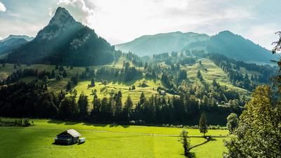
The once beautiful trail from the Tschentenalp was completely ruined last year. The beautiful section in the photo was "renewed" with coarse gravel and significantly widened. The rest was also happily "gravelled over". Any forest road is more fun.