

Türli

Description
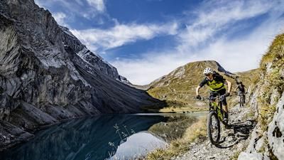
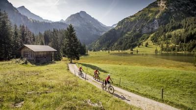
The tour starts with the ascent through the Turbachtal valley. You don't need a map or GPS device here, as the entire ascent to the Türlipass is signposted as a mountain bike route (Route 891). A total of almost 900 meters in altitude have to be overcome, with the bike having to be pushed a little at the very end, depending on your level of fitness and riding technique. From Gstaad, you ride the first few meters in the direction of Lauenen. Instead of the Lauenen valley, follow the road to Bisse and continue through the Turbach valley. Follow the Turbachbach stream to the end of the valley and climb the Türli (transition from the Turbachental to the Lauenental), where you have to push your bike for the last few meters. From Türli, a technically demanding, increasingly fast and wider trail follows to the Safret-Alp. From here, the descent to the village of Lauenen is asphalted, unfortunately there are no trail alternatives. From Lauenen, follow the trail along the Louwibach back to Gstaad. There are two options for the descent: Either you follow the signposted route consistently and don't need to use any special riding skills. Or you can keep right after Trütlisbergalp onto the trail past Seewersegg and later follow the yellow hiking trail markings instead of the red mountain bike signs. From Lauenen, the route leads back to Gstaad either on the little road or on the trail along the Louwibach stream.
Alternative: Ride the tour in the opposite direction
Map & GPX-Track
The map is only available to Ride subscribers.
The Ride-Subscription is available at ride-mtb.com/abo
.
Details of the tour
25 km
960 m
960 m
1054 above sea level
1975 above sea level
1 day
Gstaad
Gstaad
1023
not suitable
More tours nearby






User comments (1)

About the author: Thomas Giger
Note: This content has been automatically translated from German. Please report any incorrect translations.
Two years ago, I rode this tour in the opposite direction on an e-MTB without any problems. Towards the end of the tour, there is a refreshment stop at Alp Wintermatt. Tip: Shortly afterwards, take the hiking trail on the left instead of the signposted bike route. However, please give way to pedestrians and stop well, then you'll get on well together!