

Arvigrat

Description
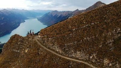
The tour starts in Dallenwil, from where you follow the road to Wiesenberg. At the end of the village, you pass the mountain railroad to Wirzweli, which shortens the ascent by a good 600 meters in altitude. The road to the Wiesenberg and on towards the Ächerlipass is steep and narrow in places, and there is not always room to cross, which is why we recommend taking the cable car. You then climb along alpine roads over the Miserengrat to the Schellenfluehütte, turn right and shoulder your bike for the remaining 200 vertical meters to the summit of the Arvigrat. The path is somewhat exposed in places, but is easy to walk if you are sure-footed. The summit panorama stretches from Pilatus across Lake Sarnen to the Bernese Alps, the Titlis and across Lake Lucerne to the Rigi.
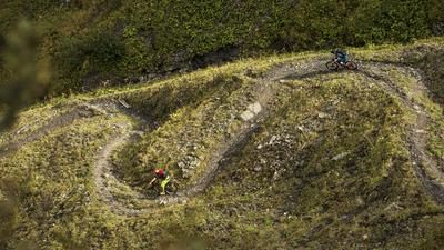
The descent really gets going at the cross on the secondary summit, from then on one first-class single trail follows the next. Finding the way to the Arvihütte is self-explanatory, from then on it is important to keep your eyes open, the trail crosses a few forest roads, but mostly follows the fall line from Heitlesboden to the Ächerlipass road. You then follow the pass road for a short distance, then branch off to the right and immediately left into a well-maintained singletrail, which first leads downhill and then slightly uphill to a gravel pit. Again, keep your eyes open to follow the rooty and stony forest trails. You reach the road to Ächerli again, follow it uphill for a few hundred meters and then branch off to the right onto a slightly wider path that marks the start of the final part of the descent, which ends in the hamlet of Wisserlen. Cross the hamlet, ride to the next section of forest and shortly afterwards take a sharp left onto a fast forest trail. Following the main road to the right, you reach a plateau and branch off to the left into the core forest, through which you reach Alpnach airfield via the trail's final fireworks. The shores of Lake Alpnach, a tributary of Lake Lucerne, are not far from here, so follow the signposted cycle route.
Map & GPX-Track
The map is only available to Ride subscribers.
The Ride-Subscription is available at ride-mtb.com/abo
.
Details of the tour
30 km
1600 m
1690 m
1 day
Dallenwil
Alpnachstad
1947
not suitable
More information
No bike schools are registered for this region. Registration as a partner takes place here.
More tours nearby








User comments (16)

About the author: Jonas Spöring
Note: This content has been automatically translated from German. Please report any incorrect translations.
Really cool ride! We took the Wirzweli cable car, which saved us about 650 meters of elevation gain. Sure, you have to push and carry the bike every now and then, but the trails down to Kerns are amazing. We rode down the Rotzloch near Ennetmoos and went swimming in Lake Alpnach—a beautiful spot, but there’s no restaurant there. We rode back to Dallenwil via Stans. Tip: Stay overnight at the Hotel Alpina in Wolfenschiessen and eat at the Eintracht—it’s really great!
A lot of carrying and a lot of pushing down
Attention: Construction work is currently taking place on the road. Be sure to check the opening times or take the mountain railroad for the ascent.
The last 200 vertical meters to the Arvigrat are very challenging, especially with an e-bike - here you have to push and carry.
The descent is a mixture of flowing sections and sometimes technical, steep passages and is definitely a highlight for trail lovers!
Video of the tour: https://www.youtube.com/watch?v=ILIGfj2bFH0
Rode on June 28, 2025.
A very impressive tour overall, with what felt like endless single trails. The only downside: the unstable, slippery rock makes the downhill more of a rodeo. Especially if you're on a trail bike with lighter tires - good for the uphill, not so good for the downhill. An enduro bike with fat tires, on the other hand, is not quite so easy to ride uphill...
Not particularly difficult in terms of riding technique, but the unstable surface and the very narrow to tight trails largely justify the 4 out of 6 "riding technique".
Currently still snow-covered in the upper part, snow-free descent on the west side from Heitletsboden.
We did the tour last Saturday, 02.11.24.
Due to the heavy fog and on a tip from you, we loaded into the Wurzweli gondola and hiked up. Very friendly and helpful staff at the cable car! Good restaurant on the mountain. Take enough liquid with you, as there are hardly any options on the way.
Pleasant uphill on asphalt and forest road. Then a foreseeable carrying passage with a top panorama.
Really a great tour! Absolutely recommendable. Everything in it: top panorama (in our case with a sea of fog ;-) technical,
rocky, then rooty ground and forest floor with fast passages = everything your heart desires!
Track was quite accurate. Keep your eyes open anyway... ;-)
I rode the tour today, it's a great tour! Took the cable car to Wirzweli, the road is closed during the week due to construction work. But I also got so tired. Pedaled for 1 hour and then shouldered my bike for 1 hour. The path is easy to walk on, but shouldering the bike is a prerequisite, otherwise it won't work. The view is fantastic. The descent is also fantastic, almost all single trails, but you have to follow the track exactly. Some parts are quite steep, which meant pushing for me. But others are very flowy and very cool to ride, so a highly recommended tour.
I rode the tour today. Unfortunately, the construction site on the Wiesenbergstrasse was impassable for bikes this morning due to falling rocks. Either turn off onto the hiking trail at the bridge beforehand, or take the cable car to Wirzweli. Then a nice ascent and finally a 300-metre carry, whereby the last 100 are partly exposed, with a bike you need surefootedness and a head for heights certainly doesn't hurt. The descent to Arvihütte is steep in the meadow and scree, rideable but more for tinkering than shooting. Dream trail in the Heitletswald forest, Canadian conditions. Then follow the GPX track, some very rewarding sections are not in Swisstopo but tiptop for riding, from here more flow, stones, roots. Overall a brilliant tour with a high proportion of trails, most of which can also be reached from Eggi as described below.
Arvi ridge
I rode this tour on 9.10.2022. The ascent was quickly completed with Bähndli and carrying the bike was no problem. The view from the ridge is sensational and highly recommended. The DH alternated between flowing and technical sections. As it was quite damp and slippery throughout, I had to get off my bike a few times, so the DH was at the limit for me. All in all, a highly recommended tour, which I will gladly repeat when the conditions are dry.
I ride a Scott Genius Ultimate and am usually in the head group uphill; downhill I'm always last, by a long way
I did this tour yesterday. The weather was pleasant and, luckily for me, there were hardly any hikers - and the few that were there were very friendly.
This tour is absolutely amazing. Even though there's a track next to it, there are still lots of bikers pedaling up. It's worth it, a pleasant ascent and a great panorama to enjoy.
I cycled up to the Schellenfluh alpine hut - it's worth stopping there, very nice alpine couple.
From the Schellenfluh you shoulder a short way up to the ridge. The absolute madness is the downhill, I still have a smile on my face 24 hours later...
The tour should definitely not be done at the weekend. This is because there are many hikers on the trail and the Arvigrat is a very popular hike. There is not much room for crossing on the ridge between bikers and hikers, it is exposed and therefore very tricky. You can imagine that hikers (rightly) don't have much fun here...
We shoulder the bike a lot, but for us the Arvigrat is not a sensible BikeBergSteiger tour. You don't always have to do everything by bike, especially not when there is a much more sensible option.
You can do this tour just as well without the ridge by pedaling up to the Egg point (1562m) and then shouldering up to the Arvihütte. The trail from the Arvihütte is super fun and well worth it.
The tour is truly sensational and a real highlight for good bikers in every respect (ascent, view, downhill). I rode the tour on June 10, 2022 under partly cloudy skies, but this in no way detracted from the view or the enjoyment of the downhill. In addition to the existing comments, here are 2.3 tips:
- If you still want some conditioning training and don't want to shorten the first few meters in altitude with the cable car, but ride up along the road yourself (I made this choice - although it was very hot at the bottom): The road is still being renovated until fall 22 and there are closed times posted at the bottom. However, the friendly construction workers are always happy to let bikes through, i.e. the road is de facto closed to bikers
- If you want to shorten the scramble on the ridge, after 200m take the path to the left along the slope to the Arvihütte. Almost everything is perfectly rideable and just as much fun as the way up.
- I always found the bike trail down very good according to the gps data - really great fun
- If you are traveling by car and want to ride a loop: there are many parking spaces at the exit of Stans, which are often empty, especially during the week. From there, cycle to Dallenwil and join the tour. At the end, cycle from Alpnachstad along the lake via Stansstad back to Stans. 44km and a good 1500m in total, according to my data.
Also with the Wirzweli cable car up to the Schellenfluhütte, a constant, problem-free ascent. After that, the bike has to be shouldered - which I don't like to do with my back. The climb is tough, but doable even for over 50s ;).
After the steep meadow, you reach the ridge. From here you continue up to the Arvigrat: you should be sure-footed and have a head for heights!
As it rained this morning, the trail to the Arvihütte was very slippery but rideable. After that we looked for the flow mentioned in the other comments and unfortunately rarely found it: The trails were very wet and the many roots and stones were seeeeeery slippery. We were able to ride down everything in a controlled manner. The trail is certainly flowy in dry weather - but it was a slippery and slippery ride. But it was still worth it!
A tour of superlatives. We took the Dallenwil - Wirzweli cable car to save the first few meters in altitude and rode to the starting point of the carrying passage. Before the ascent, we gave our bodies some sugar with orange cider in the Bäsebeizli right next door.
With the bike shouldered, the first ascent is no problem. There are two tricky sections on the ridge, but even these can be solved with teamwork.
View 10/10 in good weather.
The descent is a little slippery at the beginning due to the stones, but after the Arvi hut at the latest, a constant grin is conjured up on your face.
Track did not match everywhere with the driven one. (I use a Garmin 520) I can't say where the mistake was. We briefly checked the trail on the Swiss Topo app and always found the right route.
Absolutely recommendable!
We did the tour at the end of May. A tough ascent with a push, carry passage. But you are rewarded. Hammer trail, baller descent!!!
An absolute highlight in Central Switzerland.
Uphill it is a challenging tour, especially the last 200-300 meters of altitude as described above.
Downhill is certainly one of the longest singletrail tours I've done in Central Switzerland. Technical, flow, actually everything. Always keep your eyes open, as many trails leave the pass road.
If you still have energy left, you can certainly take Mueterschwandenberg with you. The destination would also be right by the airfield.