

Tüfengrat

Description
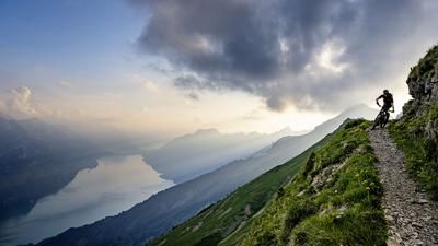
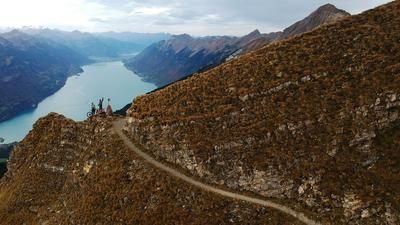
The tour begins with the gondola ride to Turren and then leads along an asphalt road to Alp Breitenfeld. A little later, turn right onto a gravel road that leads quite steeply to Berghaus Schönbüel - the highest point of the tour. Now you roll along a wide high-level path to Gibel and enjoy the panorama here: Titlis, Wetterhorn, Eiger and Jungfrau can be seen opposite, and far below, Lake Brienz fills the valley floor. Now the descent begins, initially over the ridge. The bike has to be pushed a few meters through a steep section, but the real downhill spectacle begins after the Tüfengrat. The narrow, but not particularly difficult path winds its way through the sloping terrain, with the lake visible far below and the high mountain peaks opposite. You must not fall here under any circumstances, and in some places the bike has to be pushed. This is the way down to Alp Wiler. Now it gets rougher, the path leads over alpine meadows down to Schäri. There are a few meters of forest road, then the marked hiking trail branches off to the right, which you follow to Lungern. The final section after crossing the Brünig Pass road is another highlight.
Beware: the path from Gibel to Wiler is also frequently used by hikers. It is very narrow and it is not possible to cross or overtake hikers everywhere.
Map & GPX-Track
The map is only available to Ride subscribers.
The Ride-Subscription is available at ride-mtb.com/abo
.
Details of the tour
17 km
620 m
1440 m
1 day
Lungern
Lungern
1667
limited
More information
No bike schools are registered for this region. Registration as a partner takes place here.
More tours nearby









User comments (11)

About the author: Thomas Giger
Note: This content has been automatically translated from German. Please report any incorrect translations.
I rode the tour from Lungern today. The paths are in good and dry condition. At Tüfengrat there is a very narrow and exposed section of about 20m with rope protection. But it is easy to walk. In the traverse after the Tüfengrat, there are a few places with small rifts where the bike has to be pushed. Otherwise a fantastic tour with lots of singletrack. At the campsite, a dip in the Lungernensee provided the much-desired refreshment.
Rode the tour 2 weeks ago.
Ascent with a steeper section to the restaurant, but all rideable on a wide gravel road.
Very scenic tour
Descent from the ridge very nice, then more exposed on good hiking trails. Everything is rideable, but ride defensively to avoid falls on steep terrain. The hiking trails are absolutely well maintained.
Unfortunately, from Siwhubel onwards, many meters in altitude are wasted on forest roads. Trails again from the Brünig Pass.
It is therefore worth continuing to the Eiseesattel (towards Brienzer Rothorn) and descending to Brienz, one of the most beautiful tours in the area.
Rode the tour on August 9. I was really looking forward to it, but in retrospect I have to say it was one of the three worst tours ever. The ascent is steep, but actually quite nice. The first 5 minutes of the descent over the ridge are also quite ok.
Unfortunately, that was it with the positives. The rest consists of sloping, foot-wide and poorly maintained "hiking trails", washed-out, rutted paths made of earth or simply across pasture grass. Biker-unfriendly "turning gates with barbed and electric wire" included.
My conclusion: A lousy trail where bikers were definitely not the target audience. Too bad!
I have to agree with you about the fences! The rest, in my opinion, is a matter of level or observation! There are very few places where it's better not to ride, as a fall would mean the end of the day. The rest is fantastic (but just 4*). I took the turn-off to Brienzwiler at Wiler P. 1424, having started in Brienz. Trails right into the village - pure riding fun!
I rode the tour on August 8, 2020 (start in Hasliberg, via Gibel, Gadenmattbach). From Schönbühl, the trail is justifiably marked black, as the terrain is very steep in places. It must/should be assessed in each case whether you want to ride or push certain sections (risk management....). Otherwise a very crisp tour with adrenaline included.
I rode the trail yesterday. It's true about the muddy cow pastures, more than ankle-deep mud mixed with cow dung. Fortunately, there is a car wash with a high-pressure cleaner near the Turrenbahn valley station. It's best to ask for it at the campsite.
I rode the tour in mid-July 2018 and loved it. It can also be ridden on a free afternoon from Zurich, including the journey. The cable car rides punctually every 20 minutes. The ascent takes a good hour, up to 1,800 meters it is a paved road and therefore easy to drive. It's worth taking a break at the summit rather than in the restaurant, the view of Lake Brienz is magical. The descent is varied, technically demanding and the path is often narrow. Rider errors would be disastrous - a real adrenaline rush. In the middle third, a few meters of altitude are given away on roads, but a few meters of altitude have already been given away on the track - so it's a fair deal. You pass through a few cow pastures, and if it has rained, I can imagine it is pretty muddy. The path is not easy to find from time to time, but the GPS data is very accurate - if you follow it, you will find the way. The last third is really fun and flowy - and at the end the lake smiles and invites you for a swim. Ideal for all Unterlanders for an afternoon ride.
I rode the tour on 10.07.2018 and have to say that my enthusiasm is limited. The initial 650 vertical meters to Berghaus Lungern have to be earned. It's quite a steep climb, but definitely rideable. In the upper part, the trail is not so bad (be careful with wide enduro handlebars!), but the further you get down, the more desolate it becomes (mainly meadows or cow pastures). Often the course of the route is not entirely clear (despite GPS) because the trail markings and the trail itself are very difficult to make out. So you often have to stop and get your bearings or look for the trail. Unfortunately, there are also too many, albeit short, pushing passages for my taste. A bit tedious!
My conclusion: If you don't mind getting off the bike again and again and pushing or riding over boring cow pastures, I can definitely recommend this tour. But for those who prefer technical, somewhat bumpy trails that can be ridden in one piece, I wouldn't recommend this tour!!!
The tour is quite spectacular and you shouldn't have any problems with exposed sections. The view is phenomenal. In terms of riding technique, the tour is more of a 3 out of 6 for me, apart from the very exposed sections. I found the trails rather bad after the spectacular parts at the beginning, a lot of it goes over cow pastures. From the Brünig pass road onwards it was fun and fast again.
For me, the tour goes into the "experience" category, but I don't have to repeat it purely in terms of riding.
Project 2018
will do it