

Melchsee-Hasliberg

Description
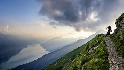
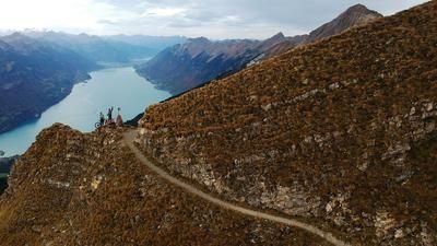
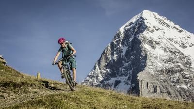
Ideally, the tour starts in Sarnen with the Postbus ride to Stöckalp and the ascent with the gondola lift to Frutt. Passing the two lakes, you then climb up to the Balmeggerhorn and then tackle the high-level trail through the extremely steep terrain to Planplatten - with the Titlis and Trift glaciers in sight. The trail is not difficult, but requires a cautious riding style. The route continues via Hääggen to Käserstatt and finally on to Gibel. Now the Rosenlaui Glacier, Wetterhorn and Eiger are within reach. The long singletrail descent to Lungern is quite rough at times. From Lungern, the route leads via Kaiserstuhl to Giswil, with only short sections on the main road. The return journey to Sarnen is either by train or along the main road.
Note: The path from Erzegg to Planplatten is also frequently used by hikers. The trail runs through very steep terrain and it is not possible to cross or overtake hikers everywhere. Mountain bikers are therefore expected to be particularly considerate. The trail should also be avoided at weekends.
Map & GPX-Track
The map is only available to Ride subscribers.
The Ride-Subscription is available at ride-mtb.com/abo
.
Details of the tour
32 km
750 m
2170 m
1 day
Melchsee-Frutt
Giswil
1384
well suited
More information
No bike schools are registered for this region. Registration as a partner takes place here.
Video
More tours nearby









User comments (13)

About the author: Thomas Giger
Note: This content has been automatically translated from German. Please report any incorrect translations.
I would not recommend this tour to anyone. The panorama is great! The trails are rather disappointing and the GPX track simply goes cross-country above Lungern. For the approach to the Balmeregghorn there is a better route parallel to it.
Why is this tour even being pushed in the July/24 print edition? I don't know.
I did the tour on 26.7. Basically it has already been said in the previous comments:
Very nice views. But that's about it. The trails are a big disappointment. Either smoothed alpine roads or then across meadows with countless fences and cow fences. No flow, but also few technical sections. A few fun passages before Lungern and the few Elevation loss from the Balmeggerhorn down before the traverse to Planplatte are top, there wasn't much more on the 32 km. It's hardly the "longest singletrail in Switzerland" - or then cobbled together at random. There are a few stretches of carrying/pushing uphill, but they are easily manageable.
In addition, the GPS data before Lungern does not seem to be correct - it simply rides across meadows and no longer follows the hiking trail. There - as already mentioned in other comments - keep left and simply descend on the hiking trail.
A detour to the Gibel cross is worthwhile!
Did the tour yesterday. The panorama and landscape are absolutely stunning. You ride up the most beautiful trails.
The descent was rather disappointing - alpine trails smoothed with gravel, double-track paths, roads and countless cow pastures. The highlight of the descent was a few short, steep technical sections through the forest.
Whether Lungern always keep left, there are nice alternatives.
Bucketlist done!
Probably the longest singletrail praline in Switzerland.
Vatiante 1 battery:
Also possible with the EMTB from Engelberg Jochpass Engstlensee then original tour Time required approx. 8.5h with a 720 Shimano but requires extreme battery management. Manually program ECO lowest level until
Lift Jochpass then it becomes extremely steep, the push mode saves battery and power and you are not much slower. Then continue to push all ECO/NORMAL steep sections and that's enough :O)....
Tip:
Variant 2 batteries:
I would recommend riding the Jochpasstrail uphill super uphill flow (only possible before the lift opens :O)) then practically everything is rideable and you absolutely have to climb the Gibel (top panorama)!
Attention:
Construction site at Lungern left then ride along the lake is nicer anyway :O)
Construction site at OWI Land Giswil Weg probably closed long term or forever so turn left over the new pedestrian bridge then follow the hiking trail...
Rode it yesterday, the panorama was great. A few comments on what has already been mentioned: I was told by someone that no bikes are allowed on the Höhenweg up to Planplatten. I have no idea whether this is correct? In any case, I would do this part of the tour early in the morning, otherwise the conflict with hikers is pre-programmed, it is quite narrow there. The descent line to Lungern is not exactly ideal, lots of cow gates (some of them difficult to pass) and obviously this route over the pastures is not intended for bikers. A few nice short single trail sections in the forest though. But otherwise a great tour.
You just have to do the tour, I can largely agree with the previous speakers. The trails are mostly easy but there are some exposed sections. But then there are sections that provide a few highlights for experts. I liked the descent from Gibel to Lungern from Hüttstett, but we followed the Trailforks track. Difficulty level S3. In terms of fitness, the tour is medium. Came to 1000 hm ascent. Has a few intervals though.
Thanks Ride for this tour tip. We were there yesterday. In terms of the panorama, it's one of the coolest tours I've ever ridden. Simply fantastic and you can hardly stop taking photos! The trails are easy in terms of riding technique, but a beginner will probably struggle mentally with the slopes. Some of the climbs are very steep and there are several uphill push/carry sections. From Käserstatt onwards, the tour was torture for me as an unfit rider without an e-bike. There were always steep uphill sections and the constant ups and downs continued all the way to the Horn. With a motor, however, this section is certainly a lot of fun. The descent to Lungern contains a few cool trails in the forest, but in the lower part it often leads over cow pastures with the corresponding "surprises" and was not such a hit, as you lose a lot of altitude and get relatively little in return. The way back from Lungern to Giswil is also a constant up and down, which pushed me to the limit and we gladly took the train back to Sarnen in Giswil.
All in all, a fantastic panoramic tour with lots of photo spots. The fact that the ups and downs were too strenuous for me is definitely down to my fitness and not the terrain itself ;-) I recommend this tour to anyone who prefers sensational mountain panoramas and interesting descents.
My rating:
Fitness 5 to 6 points
Riding technique 2 to 3 points (if 1 is "easy")
Panorama 6 points
Overall impression 5 points (because of the moderate descents)
Tour made today. Wonderful panorama. However, not very interesting in terms of trails. Overall impression 5 out of 6 would be more appropriate.
Yesterday I rode the Frutt - Tannensee - Erzegg - Balmeregghorn - Planplatten route. I had imagined the stretch from Balmeregg to Planplatten to be easier after reading the above description of the tour. ("The route is not difficult, but requires a cautious riding style"). So I thought it wouldn't be difficult, although on the Meiringen single trail map, this section is marked as a black trail. For someone who is good on black trails, it is probably not difficult but for me, who is only good on most red trails, this trail was very difficult and so I pushed the bike for most of this section. I am 74 years old and only started riding mtb 4 years ago, and I started with an e-mtb straight away. Even the more difficult trails are a lot of fun for me and I am working on getting better so that I can also enjoy the black trails. On this Melchsee tour, I especially enjoyed the view from this super panorama.
I made a YouTube video of the tour. The link is: https://youtu.be/UIWTPwRftH4
Certain stretches are impassable. This is due to the cows' footprints and the water in them. Very muddy. Certainly better to ride later in the year ;)
We started the tour from Sachseln and climbed up to Frutt via Flühli - Melchtal - Stöckalp. The gradient is pleasant, so that the 1500 meters of altitude difference up to Frutt are easy to manage. Caution is advised on the alpine road to Frutt, as many vehicles speed past you. From Frutt, the steep ascent to the Balmeregghorn begins. From there to Planplatten there are alternating short descents and steep short ascents, towards the end of the trail it becomes flatter and flatter.
From Planplatten to Käserstatt and on to Gibel there are well-maintained paths, the weather has also created small stream beds from the path which are a little rough to ride. Again, a constant up and down, which is quite challenging if you want to ride all the ramps.
From Gibel a single trail with a short running section and from Hüttstett a partly steep path down to Lungern. The path is not groomed and resembles a stream bed, alternating between flowing passages and rocky sections.
All in all, a beautiful and long tour, if you start early and master the ascent yourself, you will have a great day tour with about 60 km and 2400 hM. Ideally you should ride the tour if it has been dry for 3 days beforehand, many trails are in oily shale which can be quite treacherous when wet.
On the Gibeltrail after the border, a farmer deliberately set his dog on us with hand signals, which dampened the whole mood a little.Unfortunately, it is not the first time that we as bikers are not welcome in the canton of Obwalden, already on the ascent to Frutt we were sharply cut off by vehicles with OW license plates, whether that was just a coincidence remains open....Also greetings are apparently not known in this canton. A lunch break in Käserstatt is worthwhile, they serve good, tasty food and the people are very friendly.
We rode the tour during the week, the number of hikers was low and crossing was always easy.
Best regards Dani