

Bürgenstock Seewligrat

Description
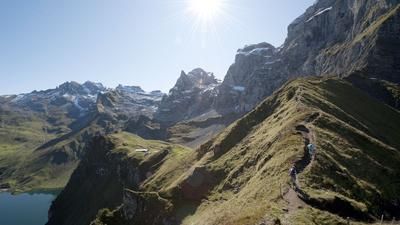
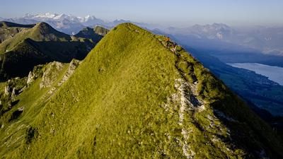
From Stansstad, climb up the main road in the direction of Bürgenstock. In Widen, turn right onto a country road and continue up to Trogen. The most important part of the ascent is done and you follow the gravel road along the south side of the Bürgenstock with its excellent view of Lake Lucerne. Finally, there are just under 100 meters of ascent to the highest point of the Seewligrat. Then the downhill fun begins on the single trail. The route initially leads along the rock band, but then turns left and winds its way down through the Bürgenberg forest to the industrial area of Stansstad. From here, you return to the starting point along the main road.
Map & GPX-Track
The map is only available to Ride subscribers.
The Ride-Subscription is available at ride-mtb.com/abo
.
Details of the tour
16 km
590 m
590 m
434 above sea level
965 above sea level
1 day
Stansstad
Stansstad
1522
well suited
More tours nearby






User comments (3)

About the author: Thomas Giger
Note: This content has been automatically translated from German. Please report any incorrect translations.
Attention, the first bend on the descent (after 11.2 km) is offset and should probably lead down 30 m earlier on the hiking trail. The GPX file led us to a ledge where it goes down 10 meters. Judging by the tracks, we were not the first to look for a path.
I have also ridden this tour and found it quite difficult. I would also rate the riding technique as 4 or 4+.
I rode the tour on Sunday, May 6th, 2018. Unfortunately, it was no FUN, as there are a lot of passages in the trail (especially in the upper part) where at least riding technique 4 or 4+ is required. I would rate the tour with riding technique 4 and adjust the color of the upper trail to black on the map.