

Urseren Höhenweg

Description
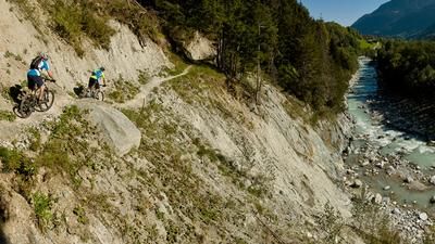
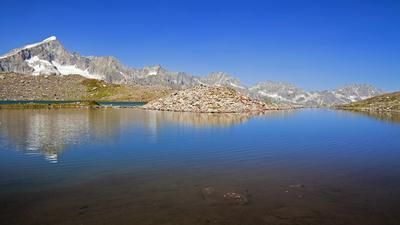
The main road down to Göschenen forms the basis for the first few meters of the tour. In the second avalanche gallery, a military road branches off to the left, which then winds its way up the steep mountain flank without any traffic. With a view deep down into the Schöllenen Gorge, you quickly gain height and finally reach the southern flanks high above Andermatt. The road climbs unabated up to the Rossmettlen-Alp. From now on, single trails are the order of the day - first down to the Lutersee lake, then up and down on the wonderfully developed trail westwards into the valley hollow of the Lochberg. Cross the stream and then take the super trail through the protective forest of Realp. This section forms the excellent conclusion of the Urseren High Trail before you roll back to Andermatt on the signposted mountain bike route along the valley floor.
Note: The descent has been subject to a bike ban since summer 2021. It is possible to ride the tour in the (less attractive but completely legal) clockwise version.
Map & GPX-Track
The map is only available to Ride subscribers.
The Ride-Subscription is available at ride-mtb.com/abo
.
Details of the tour
26 km
970 m
970 m
1 day
Andermatt
Andermatt
1736
well suited
More information
More tours nearby








User comments (19)

About the author: Thomas Giger
Note: This content has been automatically translated from German. Please report any incorrect translations.
We rode the original tour as described here. The ban through the Bannwald forest is not nice - it's a super flowy trail.....
Dear Rideteam: I wonder why the tour is still published in this version?
On October 20, 2024, I rode the "legal" version clockwise, also with a detour via Albert-Heim Hütte (route can also be found in this database). At the end of the day, I had covered 1550 vertical meters and 40 km on my organic bike (Santacruz Hightower). But I was also very annoyed not to have done this variant. I rode up the whole fun part of the Ursener Höhenweg on the legal variant and kept asking myself about the point of this variant.... Next time, I would definitely ignore the driving ban and do the "fun" and "flowy" variant in an anti-clockwise direction!
Hello dear Ride Team,
we rode the tour on August 10, 2023.
I can only say TOP.
If you can't read any prohibition signs, it's even better :-)
Can only recommend the tour from a scenic and trail point of view.
Glg
Hanspeter and Marina
I rode the tour clockwise on June 26, 2021, via Furka and Albert Heim Hütte (there is still a lot of snow)
I think the new descent to Andermatt (ends above the golf course) is very successful with a great view.
This variant complies with the ban on bikes in the forest.
I can only confirm that. Next time I will ride the tour in a clockwise direction, via the Albert Heim hut. The descent to Andermatt is really fun!
tour is still on Disentis and Andermatt Tourism MTB advertising (downloadable PDF) for 2021...
Beautiful tour! The route is well developed and a new bridge has been built over the stream. The recommended direction from Andermatt certainly makes sense, the last trail section through the Bannwald forest to Realp is great!
Very nice tour, everything rideable except the one or other stream crossing.
Top!
Did the tour today, it's super rideable. No more snowfields, the Höhenweg is generally very easy to ride, most of the tricky passages have been defused. Only as described above, I would classify the descent to Realp as S2, but only up to the entrance to the forest, then super flowing and earthy.
In my opinion, a very beautiful trail with lakes and views.
My ride impressions and pictures from June 16, 2020, published on outdooractive.com > direct link > https://out.ac/dSNmM
In which direction is this tour more fun?
Be sure to start the tour from Andermatt, otherwise you will have the road as a downhill and the flowing trail in Realp as an uphill, which would be a shame.
Super trail - but currently still interspersed with lots of snow fields that constantly interrupt the flow. Must ride the tour again in summer. A note: A short stretch from the "small reservoir" at around 2000 to the edge of the forest near Realp is quite demanding (a few steps). The parallel carriage road is more suitable for beginners.
As JT already wrote, the descent to the golf course in Andermatt has been newly developed and is now a super flowing trail 650 meters downhill!
As a variation, there is now also a flowing descent to Andermatt/Hospental!
This week (Sept. 2019) I rode the tour on the Urseren High Trail on my e-mountain bike. A wonderful tour, for me as a 73 year old mtb rookie sometimes a bit challenging but I enjoyed it to the fullest and even made a detour to the Furka Pass and a viewpoint on the Rhone Glacier. I filmed the tour with a helmet camera with gimbal and the HD video is now on YouTube and you can enjoy it from your sofa or ride along on the home trainer or jog along: https://youtu.be/A3BgGJHIOFE
Thanks to the Ride Newsletter, which pointed out this tour to me and I did it straight away.
Hello, I was there yesterday. There are still 4 small snow fields where you have to carry your bike and a stream where you have to stand up to your knees. Otherwise tip top. Super tour!!!
Thank you ! Tour done today, shoes still have to be taken off at the stream, but no more snowfields :)
PS: general comment; I would only recommend this tour to beginners to a limited extent. The singletrack is great and often flows almost continuously. But there are often exposed sections where you need to be a confident rider. The short downhill at the end, up to the start of the Bannwald forest, is very steep and challenging.
Hello, does anyone know if this tour is available from June 29th ?