

Marmolada Panoramica (Bindelweg)

Description
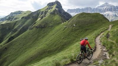
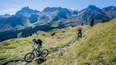
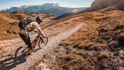
The starting point for the tour is Caprile, just north of Alleghe. From here, take a bike taxi from Alleghe or your own car up to Lago di Fedaia, where you change at the western dam wall. A cold start takes you onto the first single trail, a challenging path that becomes smoother as the distance increases. Finally, you glide down to Alba on flowing trails - always peppered with challenging passages. Here, the bike is pushed into the gondola lift up to Col dei Rossi. The high plateau at the mountain station is a panoramic spot that is second to none. The summit is undisputedly one of the most beautiful spots in the Dolomites. Many hikers are aware of this, and on the section to the Rifugio Viel dal Pan there are usually hordes of pedestrians. However, the path is wide enough to pass without any problems. The further you follow this high-level trail, the fewer people you meet. It is a trail of superlatives - fast, flowing, varied and, above all, with a stunning panorama of the Marmolada opposite. The high trail is an up-and-down, all easy to ride except for a few short sections. We continue in this style to the Rifugio Padon, where the character of the tour changes. Head down a somewhat rough path to Col de Mesdi, then keep left and finally roll down a gravel road to Rifugio Migon. Now it's time for more singletrail fun, until finally a steep gravel path in serpentine mode but with a wonderful view of the Civetta wall rides down to Caprile.
Tip: To get back to the car, ideally take the bus (Dolomiti Bus Falcade - Marmolada). The bus does not have a rear rack for bikes, but can carry up to two bikes in the luggage compartment if the driver is benevolent.
Note: The Alta Via is also very popular with hikers, especially the first section between the Col dei Rossi mountain station and the Viel dal Pan mountain hut. There can be several hundred hikers on this trail in August during the Italian vacation season. During this time, the route should be avoided by bike as the ride is not much fun then.
Map & GPX-Track
The map is only available to Ride subscribers.
The Ride-Subscription is available at ride-mtb.com/abo
.
Details of the tour
31 km
445 m
2400 m
998 above sea level
2524 above sea level
1 day
Caprile
Caprile
1802
well suited
More information
Video
More tours nearby









User comments (3)

About the author: Thomas Giger
Note: This content has been automatically translated from German. Please report any incorrect translations.
Great thing, just go to Porta Vescovo at the top left! - https://youtu.be/XRqFZYl6fNo
Is there an update on whether the tour is as passable again after the bad storms 1.5 years ago?
Checked 30.08.20 is running again