

Monte Calisio – Westabfahrt

Description
The Parco di Melta is a good starting point. Initially a few meters on the cycle path, the route later climbs uphill on side roads to Martignano and Villamontagna. The uphill from Villamontagna is particularly spectacular and epic. Here you already have a relatively good view and the historic paths give you a glimpse of great things to come. At the highest point of the tour (1096 meters above sea level) on Monte Calisio, there are first-class views of the southern Adige Valley as far as the Val Sugana, and in some places as far as the main Alpine ridge on a clear day.
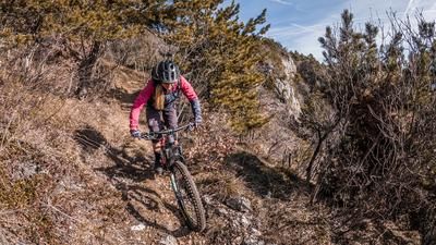
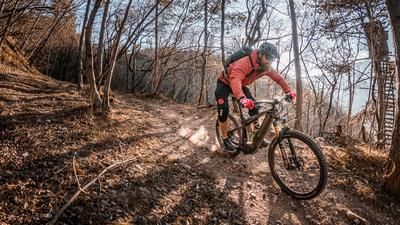
The descent begins on typical Trentino terrain. Stones, roots and a pleasant trail width make for a gentle start. The trail becomes a little more difficult later on. From Pra del Dorigat, the route then takes a relaxed route along the ridge to the so-called Hunter Trail and then steadily down the Funny Squirrel (the name says it all) on difficulty levels S1 to S2, occasionally S3. This trail finally ends on the asphalt road above Maso Bolleri. For a short time, you roll downhill in a relaxed manner before finally taking the trail at Via al maso Pezani and riding the trail cutter that leads to the starting point.
Map & GPX-Track
The map is only available to Ride subscribers.
The Ride-Subscription is available at ride-mtb.com/abo
.
Details of the tour
18 km
850 m
850 m
198 above sea level
1047 above sea level
1 day
Trento
Trento
2769
well suited
More information
More tours nearby




User comments (1)

About the author: Martin Depauli
Note: This content has been automatically translated from German. Please report any incorrect translations.
We rode the tour on 21.04.24. It's only 850 meters up, but the ascent is quite a challenge with some really steep ramps. Great view at the summit. The trail is absolutely awesome. You can really let it rip!!! Unfortunately, a few meters of asphalt are lost at the end. Nevertheless, an absolutely worthwhile tour.