

Reppischhof

Description
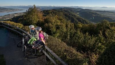
From Zurich train station, you cycle along the cycle paths to Triemli and then up to Uetliberg on the standard route. Zurich's local mountain with its fantastic view of the city, the lake and the Alps behind it is always worthwhile. For once, the descent does not take you along the familiar Antenna Trail. Instead, you keep left after the mountain station of the railroad (SZU) and follow trails and forest roads to Ringlikon. Keep left towards Birmensdorf, pass the train station and ride onto the army training area along the Reppisch. Depending on the shooting activities of the troops, you may have to take a detour or two during the week. The actual route leads along the Reppisch until a singletrail branches off to the right. Follow the trail to the "summit" and then ride downhill - still on the singletrail - to the shooting range. Passing the Reppischhof, you circle the Honeret forest and finally reach the banks of the Limmat at the highway bridge. The route rides along the right bank (looking in the direction of the river) to Zurich main station.
Map & GPX-Track
The map is only available to Ride subscribers.
The Ride-Subscription is available at ride-mtb.com/abo
.
Details of the tour
36 km
670 m
670 m
384 above sea level
856 above sea level
1 day
Zürich
Zürich
1129
well suited
More information
More tours nearby





User comments (1)

About the author: Thomas Giger
Note: This content has been automatically translated from German. Please report any incorrect translations.
Many Elevation losses on the Üetliberg are destroyed on forest trails. For the first part of the Üetliberg descent, it is better to take the Antenna Trail to the playground and then ride towards Ringlikon. The trails to Birmensdorf are then ok. After that, however, you'll lose all the altitude meters on asphalt/forest road down to the Reppitschtal bridge.
The trail down from Honeret is good. At Wiesental, the trail then follows a forest path; as an alternative, it is better to follow the hiking trail. From Stoffelbach it's time to pedal back to Zurich...
Conclusion: If you follow the gpx track exactly, the trail yield is too low for my taste and the potential is not fully exploited