

Sihltal-Tour

Description
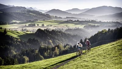
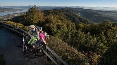
You can get to Biberbrugg from Zurich by S-Bahn via Wädenswil, the tour starts directly at Biberbrugg station. From here, you climb up to Höhronen, pass the Chlausenchäppeli and reach the Gottschalkenberg restaurant. We recommend a detour to Bellevue, a first-class viewpoint of the Hirzel and lower Lake Zurich. The tour continues from Gottschalkenberg a few more meters up to Muetegg, where the singletrail to Mangelhöhe begins. You now more or less follow the ridge up to Gubel and from here roll to Menzingen, from where you enter the narrow Sihltal valley. The fun singletrail along the Sihl begins at Sihlmatt, first through a small tunnel, then a little later you change banks and follow the trail to the right of the Sihl as far as Schiffli. Now it's time for another feat of strength: you have to climb up a steep little road to Hirzel. On the singletrail over the ridge of the Zimmerberg, you reach Gattikon parallel to the highway, ride down to the banks of the Sihl and follow it to Unterleimbach. Follow the edge of the forest past Albisgüetli back to Triemli.
Map & GPX-Track
The map is only available to Ride subscribers.
The Ride-Subscription is available at ride-mtb.com/abo
.
Details of the tour
50 km
800 m
1220 m
408 above sea level
1208 above sea level
1 day
Biberbrugg
Zürich
1309
well suited
More information
More tours nearby







User comments (12)

About the author: Thomas Giger
Note: This content has been automatically translated from German. Please report any incorrect translations.
GPX track has errors when importing into bike app, would be happy if someone uploads a current one, as the import unfortunately does not work with any app
sorry, it's a program error on my phone. The GPX file seems to be ok.
At the moment, large parts of the Sihl Valley riverside path are closed until further notice due to landslides. See Swisstopo. From Schiffli to Sihlbrugg, however, I did not see any landslides. Before the Schiffli there were massive landslides in places, I could only cross them with difficulty (trees and mud). Perhaps an ascent further up towards Hirzel would be an alternative. Otherwise a beautiful, technically easy tour, but demanding in terms of fitness due to its length.
At the start, a short technical XC route over roots. Then it's a pleasant climb up the mountain as described to Gotschalkerberg. Now begins a descent that I would rate as a max. 2 in technical terms. Once this is completed, there is a lot of asphalt. At Sihlbrugg there is also a pleasant ascent completely on asphalt. Here I recommend deviating from the tour and riding along the single trail from Horgen. This is easy and fun. Those with extra energy can ride up to the Albis Pass from Sihlbrugg.
Would rate the trail max. with riding technique 2 and fitness between 2 and 3. If you go over the Albispass, a 4 would be justified. So if you are looking for a technical challenge, you are in the wrong place. I would even go so far as to say that most of the trail is manageable on a gravel bike. For those who are looking for a panorama, however, it is definitely worth a round.
In my opinion, the part to Sihlbrugg can easily be omitted. The view is beautiful, but the proportion of asphalt roads is quite high.
The wonderful Sihlmättli is missing from the restaurants. A fresh trout is always a good idea,
https://sihlmatt.ch/
The first part to Biberbrugg along the edge of the forest is not rideable in wet conditions due to the roots. Overall, the trail was more difficult than expected - and not recommended in wet conditions.
Is there a GPX file for this route? Can't find it.
To be able to download the track, you need a Silver or Gold subscription to Ride. You will then see the download button under the elevation profile next to the map.
The tour description also no longer matches the track at the end. The track leads via Kilchberg and Wollishofen to the main station and not along the Sihl to Triemli.
A section along the Sihl is currently closed due to weather damage and will probably remain so for some time. The signpost is just before Unterschwand. You can avoid this by riding down to the Sihl via Hinterberg. After a short stretch on the left side of the Sihl, there is a bridge that leads you back onto the track.
The tour offers very beautiful panoramas and is easy to ride throughout. In my opinion, it is rated too high with a 4 for fitness. The proportion of single trails is rather small, but the trails it does have are great to ride.