

Ronda Val Gardena

Description
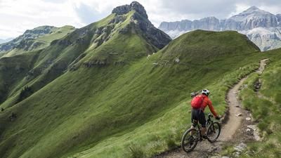
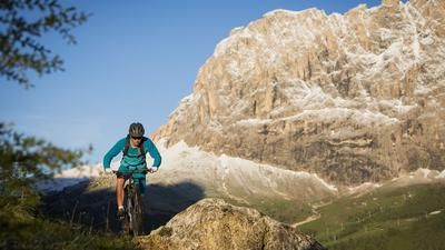
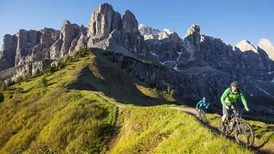
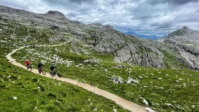
Two Val Gardena residents at the funeral of the old miner Kostner: "What did he have?" "Three hotels." "No, what was he missing?" "A ski lift." Of all the valleys in South Tyrol, Val Gardena is perhaps the most beautiful. And the cheapest. But also the most rewarding for mountain biking. The best base camp is Ortisei (1265 m), the largest village in Val Gardena. From here, you take the Seceda cable car up to 2500 meters early in the morning. Initially on gravel, later on S1 single trails, you make your way towards Col Raiser, past the Rifugio Fermeda (2109 m) to the Regensburger Hut (2037 m). An easy trail then leads via the Juac hut into the Langental valley and to Wolkenstein - including the most beautiful views of the Langkofel and Plattkofel. And straight back up again! To the Ciampinoi gondola lift (2264 meters). The trail from Ciampinoi to Monte Pana is rated S1, the alternative freeride route directly to Selva Gardena is rated S2 to S3. Once at the bottom, the fun continues: from Ortisei, you gondola up to the Alpe di Siusi, the largest high alpine pasture in Europe, and on an S1 to S2 forest trail back down to Val Gardena. Still not enough? Then take the last ascent of this long enduro day, the Rasciesa funicular, and enjoy the mega panorama of the Val Gardena Dolomites from the Rasciesa Alp: Geisler peaks and the Puez Group to the north and Sella and Sassolungo to the south. You then ride downhill on the Rasciesa trail (S1 to S2) for the last time of the day - and finish your day's work back in Ortisei. Done, but happy!
Map & GPX-Track
The map is only available to Ride subscribers.
The Ride-Subscription is available at ride-mtb.com/abo
.
Details of the tour
36 km
200 m
3600 m
1217 above sea level
2456 above sea level
1 day
St. Ulrich im Grödnertal
St. Ulrich im Grödnertal
1926
well suited
More information
No bike shops are registered for this region. Registration as a partner takes place here.
More tours nearby








User comments (1)
Note: This content has been automatically translated from German. Please report any incorrect translations.
We made the round to Ride today. Breathtaking scenery!
1st part: Seceda
is a lot of fun. Alternating trail and gravel road. You have enough time to take in the beautiful scenery. It never gets difficult.
2nd part: Ciamponoi
Great scenery here too. Trail well. Mostly on ski slope. Then really cool again at the bottom (S3).
3rd part: Alpe di Siusi
An absolute disaster! It is definitely not worth taking your bike up here. The indicated "trail" is a ski slope from top to bottom, or rather a gravel road with lots of rubble in it. As if that wasn't bad enough, there is a water drainage channel every 50 m, so you have to brake abruptly all the time to avoid getting a flat tire.
So leave the bike at the bottom, walk up, enjoy the beautiful view, have a bite to eat and take the train back down.
4th part: Raschötzer.
The upper part up to the Furnes middle station is really fun. :-) However, it should not be allowed there. But we didn't see any signs or anything similar.
From the Furnes middle station, there are two huge no-biking signs and a gate blocking the way.
There was also a rather pissed-off landowner who made it very clear to us that this was private land and biking was prohibited.
So we rode back to the middle station. From there, we had no choice but to take the alpine path (forest road and tarred road) down into the valley.
Conclusion: the scenery is mega beautiful, but not a highlight in terms of biking!