

Cimone di Crasulina – Monte Pezzet

Description
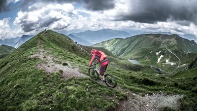
The starting point of the tour is Cercivento, near Paluzza in the Carnic Alps. From here, a military road from the Second World War, part of the Vallo Alpino defense system, rides steadily uphill to Monte Zoufplan and the transmission towers. The view from the summit is impressive, but in summer it can be very hot and waterlogged due to the ascent to the south. The ascent, which feels like half an eternity, is constant and mostly on gravel. From Monte Zoufplan, past Lake Zoufplan or Laghetti Zoufplan, you finally reach the end of the gravel road. Here you can discover some military buildings from the First World War. Optionally, you can also climb to the summit of Cimone di Crasulina, which rewards you with a breathtaking mountain panorama.
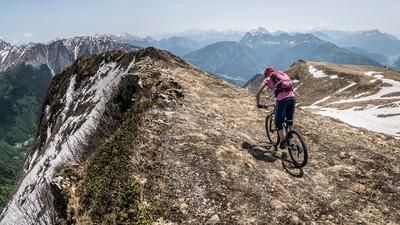
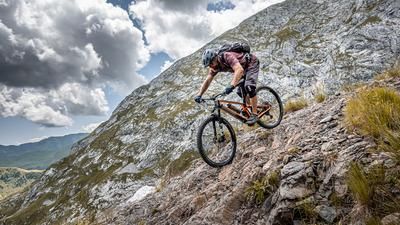
The downhill then runs between difficulty levels S2 and S3, from the summit across the entire mountain ridge to Casera Valsecca. The traverse itself is somewhat exposed and eroded in some places, while other sections are easy to ride. The route then continues past Monte Runch until you reach the asphalt road of the Vallo Alpino again below the Casera Glaretz. The previous downhill runs partly on paved Mulattiera paths. Further on, there is a short intermediate climb up to almost 1700 meters above sea level before the last big downhill of the tour begins. The downhill section becomes significantly more challenging here and moves down to level S2 and S3 at the Troi dal Gjat. The descent is quite demanding in places, with an altitude difference of almost 800 meters. In Ravascletto, the route then goes below Monte Zoncolan, known from the Italian Giro d'Italia tour, via Zovello back to Cercivento.
All in all, this is a very interesting, historic and varied tour, but it should be planned well, as thunderstorms can occur, especially in the summer months, or high temperatures can prevail on the southern slopes. In spring, caution is advised when crossing the 154er and 152er Sentiero, as snowfields can still be massive in places.
Map & GPX-Track
The map is only available to Ride subscribers.
The Ride-Subscription is available at ride-mtb.com/abo
.
Details of the tour
33 km
1580 m
1580 m
586 above sea level
2044 above sea level
1 day
Cercivento
Cercivento
3194
well suited
More information
More tours nearby






User comments (0)

About the author: Martin Depauli
Note: This content has been automatically translated from German. Please report any incorrect translations.