

Creta di Mezzodi

Description
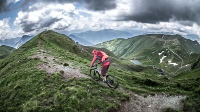
The ride starts in Lavoreit. You’ll then follow the main road for a few meters before turning left onto a paved road toward the hamlet of Lovea. Despite its remote location, the hamlet of Lovea has a high population density and is idyllically situated in the heart of the Carnic Alps. The route continues on paved road for a few more meters to the former agricultural area of Stalli Chiampees before finally switching to Sentiero 416. Here, you reach the section where you’ll need to push or carry your bike, which spans nearly 1,000 meters in elevation gain. Up to the Rifugio Monte Sernio, the trail is in excellent condition, which is rare given its historical origins dating back to World War I. From the Rifugio, the terrain becomes somewhat rougher, with two steep sections where the mountain bike must be carried with some caution.
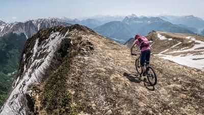
Once you reach the summit at 1,804 meters above sea level, you’ll enjoy a breathtaking panoramic view. This also explains the strategic location of the military road and trail built here during World War I. Monte Sernio, towering to the south, is particularly striking.
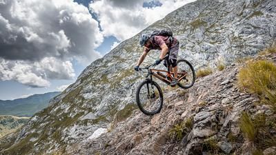
The descent runs from the summit to the Rifugio Monte Sernio at difficulty levels S2 and S3, though two sections where you’ll need to push your bike must be factored in, as riding through them would be too risky. From the rifugio, the route then descends to Stalli Chiampees at difficulty levels S1 and S2. The descent is truly breathtaking and absolutely perfect for mountain bikers. The route then continues to the next trail shortcut toward Lovea, which is rated similarly to the upper section. In Lovea, you ride through the village to the cemetery and use the village’s former footpath for the return to the starting point. It should be noted that the final section of the trail from the Lovea cemetery is only moderately maintained, so you should expect fallen trees and heavy vegetation.
Note: The route runs on the south side, so extremely high temperatures are to be expected, especially during the summer months. Due to the limited water supply, you should refill your water supplies at every opportunity. The tour can also be shortened by starting directly in the village of Lovea.
Map & GPX-Track
The map is only available to Ride subscribers.
The Ride-Subscription is available at ride-mtb.com/abo
.
Details of the tour
21 km
1310 m
1310 m
451 above sea level
1736 above sea level
5 days
Lavoreit
Lavoreit
3733
not suitable
More information
More tours nearby





User comments (0)

About the author: Martin Depauli
Note: This content has been automatically translated from German. Please report any incorrect translations.