

Monte Tersadia – Süd

Description
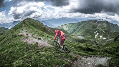
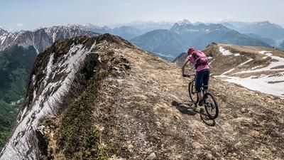
The route begins just north of Imponzo, near the small village of Cedarchis. From here, you’ll start by pedaling steadily uphill along an old military road dating back to the “Vallo Alpino” era, already enjoying very impressive panoramic views of the Carnic Alps, the Tagliamento River, and Tolmezzo. The route then continues with moderate to steep gradients toward Rivalpo, where you should refill your water supplies. Passing the church, the route—which is relatively steep in sections—leads to Malga Valmedan. After that, the section where you’ll need to push or carry your bike begins. From just under 1,500 meters to the summit at 1,960 meters above sea level, there’s a climb of approximately 450 meters in elevation to tackle. An old military road dating from World War I leads directly to the summit and offers a panorama that ranks among the best in the region. On a clear day, you can see everything from the Hohe Tauern and the Carnic Main Ridge to the border between Austria and Italy in the north, and all the way to the Mediterranean Sea in the south.
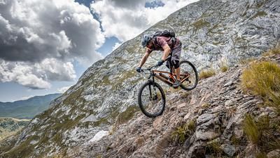
The descent from the summit to Malga Valmedan is rated S2 and S3 in difficulty. In some places, the trail has eroded somewhat, which is why route selection is particularly important here. From the Malga, the route follows the “Direttissima” down steep switchbacks; caution is especially advised at the transitions due to the curves. You then cross the CAI Trail 410 toward Sella di Suart and also come to a military road. At the first crossing, expect a short section where you’ll need to push your bike for just under 50 elevation losses, as the trail here is extremely steep, technical, and exposed. It is absolutely essential to avoid slipping in this section. Further along, the trail becomes increasingly smooth, initially fluctuating between difficulty levels S1 and S2, and finally settling at S1 from Sella di Suart onward. The route continues at this difficulty level all the way to Arta Terme. From there, take the bike path for a leisurely return to the starting point.
Map & GPX-Track
The map is only available to Ride subscribers.
The Ride-Subscription is available at ride-mtb.com/abo
.
Details of the tour
30 km
1620 m
1620 m
402 above sea level
1905 above sea level
1 day
Imponzo
Imponzo
3713
limited
More information
More tours nearby






User comments (1)

About the author: Thomas Giger
Note: This content has been automatically translated from German. Please report any incorrect translations.
Our BnB Bondi Gemona is the ideal place to stay for cyclists in Friuli. www.bnb-bondigemona.ch We're also listed in Ride's hotel directory.