

Monte Terzo – Römerstrasse Via Iulia Augusta

Description
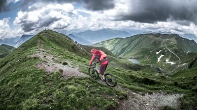
The first turns of the pedals take place in Cercivento. From here, the former military road from the Second World War climbs steadily and seemingly endlessly. The road is part of the Vallo Alpino defense segment in the Carnic Alps. Initially on asphalt and later on gravel, the road winds its way uphill and reaches the tree line at an altitude of around 1500 meters above sea level, where the panorama changes abruptly. You pedal uphill with good views towards Tolmezzo and into the heart of Friuli as far as Slovenia. At Pizzo del Corvo, the hardest part is over. From here, the route is relatively relaxed below Monte Zoufplan and the large antenna until you finally reach the junction of Sentiero 154.
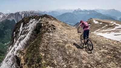
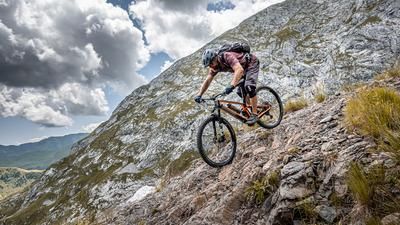
This is where the first downhill begins. At difficulty levels S1 to S2, the route descends to the saddle and then climbs in the same manner to the counter ascent of Monte Terzo (2034 meters above sea level). It was up here that a desperate battle was fought during the First World War. Close to the Plöcken Pass and facing Austria/Hungary, a defensive system was built in the entire area, fragments of which can still be seen today. Part of this defense system is also the Alpini Trail, which subsequently serves as a downhill trail. At difficulty levels S1 to S2, the trail descends Sentiero 155 with hairpin bends and a steady gradient past the alpine buildings. Continue along the ridge towards Rio Sgolvais and the small village of Placcis. From here, there is a small ascent and then the Roman road, which is in perfect condition, past Ramazzaso and back to the starting point.
Map & GPX-Track
The map is only available to Ride subscribers.
The Ride-Subscription is available at ride-mtb.com/abo
.
Details of the tour
30 km
1500 m
1500 m
562 above sea level
1978 above sea level
1 day
Cercivento
Cercivento
2747
limited
More information
More tours nearby





User comments (0)

About the author: Martin Depauli
Note: This content has been automatically translated from German. Please report any incorrect translations.