

Kampenwand: Sunset Magic Trail

Description
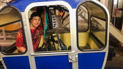
The starting point of the tour is either Aschau im Chiemgau (615 meters above sea level), from where it goes via the Kohlstatt district, the Maisalm (900 meters above sea level), the Gorialm (1240 meters above sea level) and the Steinlingalm (1473 meters above sea level) on consistently good, albeit sometimes steep forest roads and paths to the mountain station of the Kampenwandbahn (1457 meters above sea level), which is also the second starting point of the tour. Bike transport with the gondola lift is possible from 1.30 pm until closing time. Costs for the ascent per bike (no e-bikes) an additional 5 euros.
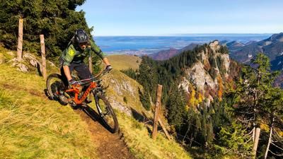
From the mountain station of the gondola lift, it's a short descent to the Möslarnalm (1450 meters above sea level). From here, head almost due west across the alpine pasture area until you reach the pasture fence with a slip-through. From here, head almost due west across the alpine pasture area to the pasture fence with a slip-through. From here, the climb, which is not marked, is clearly visible, but initially not very rewarding for bikers. Without any significant loss of altitude, the trail initially leads horizontally for about 500 meters through mountain pine fields and over scree. Most of it is rideable, but every now and then an unruly mountain pine root or a large boulder blocks the way. But you are royally rewarded for this short slog. Once you have reached the light-flooded mountain forest at around 1400 meters above sea level, the perhaps most varied, but certainly the most flowing trail in the entire Kampenwand area begins - and that's saying something, because this mountain probably offers more mountain biking fun than many an entire mountain range!
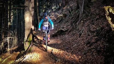
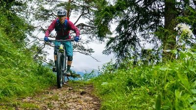
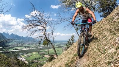
The trail leads downhill through sparse but moderately steep mountain forest until you reach a clearing with a beautifully situated service hut at around 1100 meters above sea level. What follows is the absolute icing on the cake of this tour: the light-flooded forest with meadow floor becomes steeper, sometimes really steep. But the trail does not. It winds its way through the terrain in wonderful serpentines with a perfect gradient. A real dream for anyone who loves challenging natural alpine flow trails. The only thing that can slow down the flow here are tree trunks lying across the trail. These are occasionally cleared away or sawn off, but this seems to take more time here than on the frequented and marked trails in the well-known part of the Kampenwand.
At the very end, before the trail crosses a forest road and rides over the last few meters of the so-called bridle path into the Aschau district of Brückl (650 metres above sea level), an exciting passage awaits at a collapsed bridge. The brave cross the approximately five-metre-wide stream on one of the still intact, 30-centimetre-wide double T-beams of the former bridge, while others simply carry the bike through the stream bed.
From Brückl, the trail finally leads along the main road back to the center of Aschau im Chiemgau.
Map & GPX-Track
The map is only available to Ride subscribers.
The Ride-Subscription is available at ride-mtb.com/abo
.
Details of the tour
16 km
900 m
900 m
604 above sea level
1509 above sea level
Aschau im Chiemgau
Aschau im Chiemgau
3269
limited
More information
More tours nearby




User comments (3)
Note: This content has been automatically translated from German. Please report any incorrect translations.
Thanks for your feedback! We rode the trail in spring - it was in good shape then (for an unmarked hiking trail). In summer, it can quickly become overgrown if the trail is not maintained. The trail is challenging, wild and not everyone's cup of tea. Nevertheless, many locals love it - especially in the afternoon when the sun is low in the sky.
I rode the tour on 15.8.24 - from my point of view the description doesn't match the trail. The trail is totally overgrown, trees are lying across, there is really no trace of flow here.... S3+ I would say
Rode the tour on 7/15/2014:
https://www.emtb-news.de/forum/threads/e-mtbs-in-freier-wildbahn-bilder…