

Kampenwand Reitweg

Description
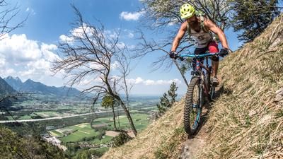
The Kampenwand (1669 meters above sea level) is the landmark of the entire region, an all-rounder mountain: climbing, skiing, hiking, paragliding, mountain biking. In addition, more than ten mountain huts (the legendary mountain bikers' regulars' table is held on Thursdays at the Steinlingalm) invite you to enjoy a snack with a view. Fans of full-suspension bikes in particular get their money's worth on this mountain, as the mountain is open to hikers AND mountain bikers on all hiking trails (as indicated by signs), regardless of the Bavarian "general right of access". To keep it that way, mutual consideration is of course required. Despite the official opening, the trails on the Kampenwand are not overcrowded with bikers. This also applies to the Reitweg, a great and logical trail from the Kampenwandbahn mountain station down to Hohenaschau. Speaking of the Kampenwandbahn and what many people don't know: From 1.30 pm, you can also let your bike swing comfortably up the mountain in the nostalgic gondolas. Which brings us back to the subject of the belly...
From Aschau in Chiemgau (615 meters above sea level) via Kohlstatt on the asphalted alpine path up to the Maisalm area (900 meters above sea level). Continue on a gravel road into the so-called "Goriloch" and up steep hairpin bends to the Gorialm (1240 meters above sea level). Take a break! Fantastic view over the entire Chiemsee. Continue up a moderate incline towards the Steinlingalm (1437 meters above sea level). If you still have energy here, you can climb the rocky head of the Kampenwand in around 20 minutes. A phenomenal panoramic view rewards the fun (provided you have a head for heights). Those who prefer to replenish their energy stores can stop off at the Steinlingalm (be sure to try the Hohenaschauer Gamsbier!). The route to the Sonnenalm (1500 meters above sea level) and the mountain station of the Kampenwandbahn cable car is almost flat via the time-honored bridle path, which trail riders will not leave until they reach the valley.
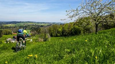
Helmet on, protectors on the wild ride along the bridle path begins... Initially quite harmless along a steep gravel track past the Möslarnalm (1450 meters above sea level) and further along the ski slope until the original bridle path branches off to the right again at 1320 meters above sea level. The descent to the Schlechtenbergalm (1260 meters above sea level) is steep, rocky and far from easy. Here you can enjoy another Bavarian beer, as you have already mastered the greatest, if not all, of the difficulties. Enjoy a tomato sandwich with egg with your beer, because it tastes particularly good here. The route continues along the bridle path, initially easy over a meadow trail, later quite rooty and bumpy in the forest to the place of worship "Bei unser lieben Frau". Here you switch briefly to a forest path, which quickly turns into a trail again. Via a forest road, initially downhill, later briefly uphill, the bridleway trail turns off again in serpentines into the valley at a good 1000 meters above sea level. You now follow this trail, which is flowy but sometimes blocked, until you reach the Aschau district of Brückl. From here, take the main road back to the starting point.
Map & GPX-Track
The map is only available to Ride subscribers.
The Ride-Subscription is available at ride-mtb.com/abo
.
Details of the tour
19 km
960 m
960 m
606 above sea level
1512 above sea level
1 day
Aschau im Chiemgau
Aschau im Chiemgau
2449
well suited
More information
More tours nearby









User comments (0)
Note: This content has been automatically translated from German. Please report any incorrect translations.