

Monte Ramaceto

Description
The route starts in the Ligurian hinterland, near San Colombano. First follow the main road for a short while before switching to an idyllic cycle path that runs north along the Torrente Lavagna. This takes you to the small hamlet of Pianezza. From there, a paved road continues to Orero, where you can fill up your water reserves at the church. The route then continues towards Monte Zuccarello before the road surface changes: From here, you pedal on gravel to the end of the road and the parking lot.
From this point, you will be pushing: You take the bike along the rocky ridge to Bocca di Feia and then follow the gently rising mountain ridge to the summit of Monte Ramaceto. The ascent is partly on loose ground, later through magnificent beech forests. The summit is marked by a small chapel and offers a fabulous panoramic view, especially when the air is clear in spring or fall - a real highlight.
The descent then begins - with two variants:
- Variant 1 (challenging): For technically experienced riders with alpine experience, sure-footedness and a willingness to carry or push, we recommend crossing the ridge via the slate scree field. This section is challenging (S4+) and rejoins the main route at Pian dei Baci. The views along the ridge are spectacular, but the route is only suitable for experienced hikers.
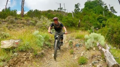
- Variant 2 (classic): For everyone else, we recommend the descent towards Bocca di Feia (S1-S2) and continuing along the historic Mulattiera trail, below the summit, to Passo del Dente. A technically interesting, panoramic descent with a pleasant trail flow throughout.
In a similar manner, on difficulty levels S1 to S2, occasionally S3, follow the path to the junction at Passo di Romaggi (722 meters above sea level). From here, the so-called "trail of 7 steps" begins, which rides over partly overgrown, thorny sections, through forests and over hairpin bends, flowing passages and key sections to Monte Pissacqua. From there, the trail winds its way down the mountain ridge to Maggi, where the transfer route back to the starting point begins.
Conclusion: A varied, challenging all-mountain tour with a spectacularly scenic summit area. Particularly noteworthy are the two descent options from Monte Ramaceto - whereby the ridge variant (not included in the GPX track) is extremely challenging, but the scenery is out of this world.
Map & GPX-Track
The map is only available to Ride subscribers.
The Ride-Subscription is available at ride-mtb.com/abo
.
Details of the tour
35 km
1295 m
1295 m
31 above sea level
1265 above sea level
San Colombano Certenoli
San Colombano Certenoli
3448
limited
More information
More tours nearby




User comments (0)

About the author: Martin Depauli
Note: This content has been automatically translated from German. Please report any incorrect translations.