

Levanto Trail-Kombi

Description
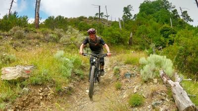
Departure number one rides along the legendary Levanto Supertrail, starting just below the Colle di Guaitarola. This trail is one of the best and longest in the entire region and is a highlight. The trail is extremely varied: sometimes fast and playful, then technical and challenging, sometimes flowing and smooth, then rocky and blocked. This trail stretches for almost five kilometers to the center of Levanto.
Number two on the day's itinerary is the magnificent Monte Piano Trail, which starts just below Monte Pistone. The shuttle ascent runs along an asphalt road to an agriturismo directly below the start of the trail. The descent begins quickly and playfully, soon crosses a road and then turns into a steeper section with tight hairpin bends. As soon as you reach the olive groves, the trail switches into flow mode once again - pure riding fun all the way to the charming village of Vignana. From here, you continue on a final trail section to the valley floor near Levanto.
Number three: This is where the somewhat wilder San Bartoumé trail comes into play. The start is on the road that runs along the ridge high above the valley floor of Levanto. This trail is very similar in character to the Monte Piano Trail - although it is often more overgrown and rougher. Depending on the time of year, the vegetation can be denser here. The end of the trail is in the same region as the previous descent.
Number four brings another real trail delicacy: the start is at Monte Crocettola (just before the start of the San Bartoumé Trail), from where the trail of the same name - short, playful and fun - leads up to Colla di Gritta. On the opposite side of the road, a tough trail climb begins with around 110 meters of elevation gain up to Monte Rossini. With a sturdy e-bike, the climb is rideable up to a few meters, but many push the bike to the summit. The Rossini Trail awaits at the top - fast, flowing, sometimes steep, sometimes flowing, interrupted time and again by rapid passages through pine forests. This descent is another real trail highlight and leads directly into the town of Levanto for an aperitif in one of the many bars and cafés.
Map & GPX-Track
The map is only available to Ride subscribers.
The Ride-Subscription is available at ride-mtb.com/abo
.
Details of the tour
66 km
2720 m
2720 m
4 above sea level
691 above sea level
Levanto
Levanto
3418
well suited
More information
More tours nearby




User comments (1)

About the author: Thomas Giger
Note: This content has been automatically translated from German. Please report any incorrect translations.
Exit no. 3 currently not recommended and dug up by wild boars and unkempt/hardly used. Many stones and completely churned up ground