

Levanto Backyard

Description
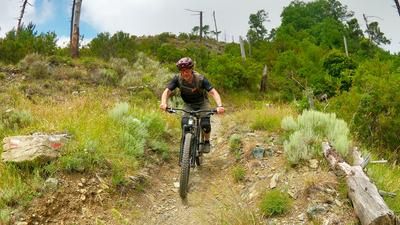
From the center of Levanto, follow the road uphill to Colla di Gritta and on to the Saviore church. Turn left there and follow a small road that runs high above the Levanto basin. Soon you turn right and reach the start of the Bandia Trail. Depending on the time of year, this section can be somewhat overgrown - in this case, we recommend taking the gravel road that leads over to Monte Bandia as an alternative. This is where the actual descent begins: a varied, playful and agile single trail that rides through the forest with plenty of flow. Incidentally, it is the only really worthwhile trail descent into the hinterland of Levanto. The Bandia trail ends in the small village of Casale.
The ascent back to the mountain ridge then begins. The hilly asphalt road takes you to Cassana. Here you change to a gravel road that winds uphill in numerous bends. Immediately before a farm - just before the road is asphalted again - turn right and tackle the last few meters in the direction of Monte Pistone. This is the start of the magnificent Monte Piano descent back to Levanto. The trail starts quickly and playfully, leads to a road and continues immediately behind it - now much steeper and with tight hairpin bends. As soon as you reach the olive groves, the trail really picks up speed again: Pure flow all the way to the village of Vignana. Here you cross the road again and head directly down to the valley floor at Levanto on a final trail section.
Map & GPX-Track
The map is only available to Ride subscribers.
The Ride-Subscription is available at ride-mtb.com/abo
.
Details of the tour
37 km
1420 m
1420 m
5 above sea level
691 above sea level
1 day
Levanto
Levanto
2445
well suited
More information
More tours nearby




User comments (1)

About the author: Thomas Giger
Note: This content has been automatically translated from German. Please report any incorrect translations.
Levanto gute Alternative zu Finale, halt ohne Shuttle, aber E-Bike ist empfehlenswert, knackige Anstiege und zweiter Anstieg auf Schotterstrasse. Erster Trail-Abschnitt wunderbar, zum Glück GPS , da zeitweise mit Farn zugewachsen – trotzdem gut fahrbar (keine Dornen) und Endlos-Trail, kein starkes Gefälle. Auch der zweite Trail sehr cool obwohl man aufpassen musste, da es Regenrinnen gab, da es vermutlich vorher einmal sehr starken Niederschlag gab. Der letzte Abschnitt auch hier lose Steine und steil, aber mit ein wenig Mut fahrbar. Vielen Dank an Ride für solche Touren, die man sonst nicht finden würde.