

Wodenalm

Description
The tour starts in Matrei in East Tyrol, right at the entrance to the picturesque Virgen Valley. First, you follow the official cycle route uphill to the hamlet of Zedlach, which lies at around 1300 meters above sea level. The ascent is entirely on asphalt and rewards you with a fantastic panoramic view of the Virgen Valley and the surrounding mountains. The sunny plateau of Zedlach is a real highlight in spring and fall. From Zedlach, the route continues on gravel: a forest path through larch forests leads up to the Wodenalm (approx. 1800 meters above sea level). The alpine pasture, which is open in summer, offers an ideal place to stop for refreshments with spectacular views to the south of the Lienz Dolomites and to the west towards Gorner and Kals.
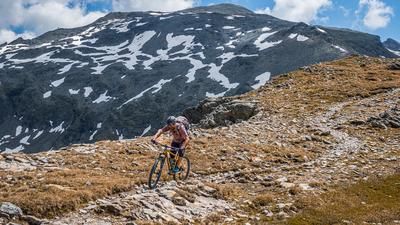
After the Wodenalm, the descent begins on the so-called Bretterweg trail. This runs through alpine pasture terrain, technically not too demanding, but varied: difficulty S1 to S2, ideal for experienced all-mountain bikers. The trail ends at the Strumerhof farm, where a transfer section on asphalt and gravel follows towards Hinteregg - a beautifully situated farm on another panoramic plateau.
From Hinteregg, you return to a historic alpine path that winds its way downhill in serpentines. The riding technique requirements remain in the S1 to S2 range, the trail offers a perfect mix of nature experience, riding fun and trail history. These old paths were once used for alpine farming and now ride through scenic terrain back down into the valley. Once you reach the valley floor, you will come across a forest trail along the Tauernbach stream, which is ideal for the way back. A possible alternative via the Prosseggklamm gorge is not recommended - the narrow path is heavily frequented by hikers, extremely exposed in places and dangerous in the Alps. Instead, continue along the Tauernbach stream, then take a short trail section to the chapel before cycling the last few meters on asphalt to Prossegg and finally back to Matrei.
Note: The route is located on Austrian territory and leads over routes that are not approved for mountain bikers. Riding this route on a mountain bike is the responsibility of each individual, in full awareness of the legal situation.
Map & GPX-Track
The map is only available to Ride subscribers.
The Ride-Subscription is available at ride-mtb.com/abo
.
Details of the tour
18 km
850 m
850 m
938 above sea level
1776 above sea level
Matrei in Osttirol
Matrei in Osttirol
3435
well suited
More information
More tours nearby


User comments (1)

About the author: Martin Depauli
Note: This content has been automatically translated from German. Please report any incorrect translations.
We did the tour on October 11, 2026. The views are great (we even hiked to the summit) and the descent is a lot of fun. In the upper section, however, I’d rate it S2 practically the whole way. The lower section is mostly S1, as described. Keep in mind that just before the end of the trail descent, there’s a stream crossing where the path is largely destroyed. On your own, it’s likely to be quite a challenge to haul your bike through this ravine. With two people, it’s quite manageable. Overall, a rewarding tour with beautiful trails and delicious cake at the alpine hut.