

Türmljoch

Description
The starting point of the tour is Hinterbichl. From here, the official mountain bike route rides on gravel roads with medium and even gradients up to the Johannishütte. Shortly before this, turn left, push your mountain bike a little and then carry it several hundred meters up to the Türmljoch at 2772 metres above sea level.
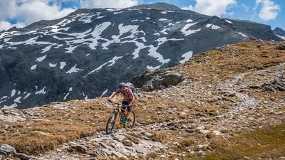
The pass itself is impressively nestled between the mighty peaks of the Venediger group in the heart of the main Alpine ridge. Then the descent begins. The smoother sections correspond to difficulty levels S2 to S3, with individual passages also reaching level S4. The varied descent leads down to the Essener-Rostocker Hütte and offers everything that makes a mountain biker's heart beat faster: tight hairpin bends, blocked granite fields and flowing, homogeneous passages in between.
At the Essener-Rostocker Hütte, you circle the building before the trail becomes more challenging again. On sections of difficulty S2 to S3, occasionally S4, the trail rides steadily southwards through the Maurertal valley towards the valley floor. Only towards the end does the trail become easier and runs over even, easy sections until you finally reach the valley floor again in Ströden in Virgental. From there, it is just a short transfer back to Hinterbichl, the starting point of the tour.
All in all, this is an extremely scenic but challenging tour. It should be noted that some sections are located in the Hohe Tauern National Park, where the mountain bike must be pushed.
Note: The route is located on Austrian territory and leads over routes that are not approved for mountain bikers. Riding this route on a mountain bike is the responsibility of each individual, in full awareness of the legal situation.
Map & GPX-Track
The map is only available to Ride subscribers.
The Ride-Subscription is available at ride-mtb.com/abo
.
Details of the tour
22 km
1390 m
1390 m
1351 above sea level
2754 above sea level
1 day
Hinterbichl
Hinterbichl
3598
not suitable
More information
More tours nearby


User comments (0)

About the author: Martin Depauli
Note: This content has been automatically translated from German. Please report any incorrect translations.